The Best Hiking in Pine
Looking for the best hiking in Pine? We've got you covered with the top trails, trips, hiking, backpacking, camping and more around Pine. The detailed guides, photos, and reviews are all submitted by the Outbound community.
Top hiking spots in and near Pine
-
Pine, Arizona
Highline and Pine Trail Loop
1.56 mi / 331 ft gainHighline and Pine Trail Loop is a loop trail where you may see wildflowers located near Pine, Arizona.Read more -
Pine, Arizona
Oak Spring Trail
7.41 mi / 1168 ft gainOak Spring Trail is an out-and-back trail where you may see wildflowers located near Pine, Arizona.Read more -
Pine, Arizona
Hike the Pine Creek Loop in Tonto Natural Bridge SP
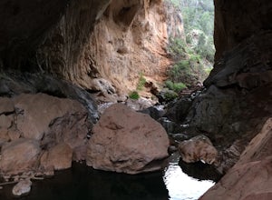
4.71.8 mi / 300 ft gainThere is a fee to enter this area. It was $7 when we went. There are 4 trails with many viewpoints from the parking lot, all of which are out and back. We followed the recommendation of the ranger working at the visitor's center and took the Gowan Trail down to the observation deck located in the...Read more -
Pine, Arizona
Bob Bear Trail
5.08.58 mi / 1650 ft gainThe Bob Bear Trail (formerly Fossil Springs Trail) is a 8.3 mile out-and-back hike that takes you through a challenging, exposed trail to a waterfall in Tonto NF near Pine, AZ. Make sure you bring plenty of water for this hike 2-3L per person and give yourself ample time to get out and back. This...Read more -
Pine, Arizona
Fossil Creek Falls
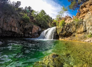
4.82.42 mi / 328 ft gainThe journey is definitely worth it! Don't let the description discourage you from visiting here. This is simply to help you be prepared so that you can enjoy this wonderful place as safely as possible! Fossil Creek Rd can only be accessed from Camp Verde via FH 9 (Hwy 260) and FR 708 due to road...Read more -
Pine, Arizona
Flume Road Trail
9.02 mi / 1837 ft gainFlume Road Trail is an out-and-back trail that takes you by a river located near Pine, Arizona.Read more -
Coconino County, Arizona
Hanging Garden OHV Route
12.14 mi / 1555 ft gainHanging Garden OHV Route is an out-and-back trail in the West Creek Wilderness located near Strawberry, Arizona.Read more -
Payson, Arizona
Water Wheel & Ellison Creek Cascades
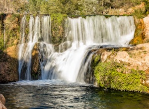
4.91.76 mi / 272 ft gainA short and easy out and back hike for adventurers of all ages with scenic waterfalls along the entire trip! Starting at the Water Wheel day use area you will simply follow the well traveled path that meanders alongside the creek. You will reach the first significant waterfall within minutes whi...Read more -
Payson, Arizona
Ellison Creek Cascades
1.5 mi / 217 ft gainEllison Creek Cascades is an out-and-back trail that takes you by a waterfall located near Payson, Arizona.Read more -
Payson, Arizona
Mogollon Rim via Washington Park
4.04.32 mi / 1138 ft gainThis trail begins at the Washington Park Trailhead which meets up with passage #27 of the AZT. You begin traveling northbound as you ascend the great Mogollon Rim. The trail takes you through a gorgeous forest and rewards you with an awesome cliff side view at the summit. 2.25 miles into the tra...Read more -
Payson, Arizona
Hike the Colonel Devin Trail
4 mi / 1116 ft gainThe hike will begin at Washington Park in Payson, Arizona. To reach Washington Park, take AZ87 to Forest Road 199 (Houston Mesa Road) and turn east. Continue for 10 miles until you reach Forest Road 64 and turn west. Traveling less than a mile you will turn north on Forest Road 32 and in 3 miles ...Read more -
Flagstaff, Arizona
Calloway Trail
1.25 mi / 623 ft gainCalloway Trail is an out-and-back trail that takes you by a river located near Strawberry, Arizona.Read more -
Payson, Arizona
Fred Haught Trail
7.65 mi / 942 ft gainFred Haught Trail is an out-and-back trail that takes you through a nice forest located near Happy Jack, Arizona.Read more -
Payson, Arizona
Cabin Loop Trail
18.82 mi / 2028 ft gainPeople think Arizona is all just desert, but this hike will show you otherwise. Up on the Mogollon Rim, this trail takes you past old cabins, through lush forest, and near many creeks. Day 1: (10 miles) Drive on Rim Road to the General Springs Trail Head. The cabin marks the start of the tr...Read more -
Payson, Arizona
Cabin Loop: Houston Brothers - U-Bar
20.48 mi / 2740 ft gainCabin Loop: Houston Brothers - U-Bar is a loop trail where you may see beautiful wildflowers located near Happy Jack, Arizona.Read more -
Payson, Arizona
Houston Brothers Trail
14.31 mi / 1483 ft gainHouston Brothers Trail is an out-and-back trail where you may see wildflowers located near Happy Jack, Arizona.Read more


