The Best Hiking in Kentucky
Looking for the best hiking in Kentucky? We've got you covered with the top trails, trips, hiking, backpacking, camping and more around Kentucky. The detailed guides, photos, and reviews are all submitted by the Outbound community.
Top hiking spots in and near Kentucky
-
Slade, Kentucky
Hike the Indian Staircase Loop and Cloudsplitter
5.010 miStarting at the Bison Way Trailhead #210. You'll take this until you come to the intersection of the Sheltowee Trace Trail #100. Go left. You're going to turn right on the unmarked trail just past the sign that says stay on trail. This is quite the incline. Keeping going until you get to the base...Read more -
Pineville, Kentucky
Explore the Lookout from Chained Rock
5.0Located just north of the Cumberland Gap, Chained Rock is a local landform made unique by a long slung chain that comes with a tall tale of it's creation. According to legend the rock pinnacle overlooking the Cumberland River valley struck fear into the minds of young children, which was eased wi...Read more -
Berea, Kentucky
Hike the Pinnacles in Berea
4.96.59 mi / 1014 ft gainThis is a trip with multiple sites to visit over the course of a day. Visiting all five would equal around 5 miles, or you can choose to only go to one, as there are some slightly strenuous hills. The most visited is the Main Lookout, and the West Pinnacle offers a little rock climbing. Between ...Read more -
Slade, Kentucky
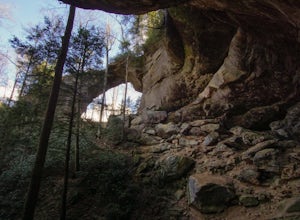
Hike to Natural Bridge and Battleship Rock
3.82 mi / 400 ft gainThis popular hike begins near the state park gift shop and has options to continue to other trails at multiple points. The first .75 miles, starting at about 800 feet, is the hike up to the Natural Bridge. This portion of the hike contains basically all of the increase in elevation. As you hike u...Read more -
Stanton, Kentucky
Hike to Courthouse Rock and Double Arch
5.06.1 miStart at the trailhead located just past the Gray's Arch picnic area. Follow Auxier Ridge Trail #204 (white diamonds). You will pass a trail junction at 0.9 miles, but continue on Auxier Ridge. At the following fork in the trail keep right.Along the trail, you will catch views from the ridge of R...Read more -
Stanton, Kentucky
Hike to Gray's Arch
5.03.3 miThe trail approaches the arch through a ravine, passing by cliffs, dense forest, and a stream (Kings Branch) en route.Read more -
Stanton, Kentucky
Hike the Auxier Ridge Trail, KY
5.04 mi / 1300 ft gainThis can be done as a quick hike, or as an overnighter so you can catch both sunset and sunrise. Park at the Auxier Ridge Trailhead and take the Auxier Ridge Trail (#204). Do NOT take the branch on the left for the Courthouse Rock Trail (#202), which you will see after about 1 mile. In about 2...Read more -
Pine Ridge, Kentucky
Hike to Whittleton Arch
5.02 mi / 280 ft gainStarting from the Whittleton Campground, you will follow along a stream until reaching the Whittleton Arch Trail at 0.75 miles. Turn right to reach the arch. It is also worth noting that this is the only pet friendly trail in the park. You can add on the nearby Henson's Arch (0.5 miles) to your d...Read more -
Olive Hill, Kentucky
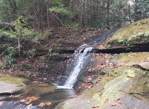
Hike to Lick Falls
5.03 miThe Grayson Lake State Park has two trails – the Lick Falls Loop Trail, and the 0.8 mile Beech-Hemlock Forest Trail. Lick Falls is best done after a rain, to make sure the falls are flowing. A trail map of the park can be found here.Read more -
Williamsburg, Kentucky
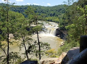
Eagle Falls, Cumberland Falls SRP
4.81.89 mi / 699 ft gainRated easy to moderate, this hike does have lots of stairs. Rated easy to moderate, this hike does have lots of stairs. Along the way to Eagle Falls you will pass one of the best views of Cumberland Falls. Part of the lower trail may at times be muddy or inaccessible due to water levels.Read more -
West Point, Kentucky
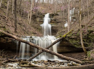
Hike to Tioga Falls
4.71.9 mi / 354 ft gainRecently the trail to Tioga Falls has re-opened even though they are still doing trail restoration. This is short little 1.9 mile out and back trail is perfect for the family and has one of the best waterfalls if you live anywhere near Louisville, Kentucky. Now while there is about 350 feet of el...Read more -
Pine Ridge, Kentucky
Backpack Chimney Top Loop
4.010.7 mi / 40 ft gainStart out on Koomer Ridge Trail to see Hidden Arch. You will then head into the Right Fork Chimney Top Creek watershed, where you'll spend the night. The next day, hike along Buck Ridge to Sheltowee Trace Trail. Gray's Arch is located off of this trail. After stopping at the arch, rejoin Sheltowe...Read more -
Lexington, Kentucky
Hike Raven Run Nature Sanctuary Trail
3.74.1 mi / 1089 ft gainRaven Run Park is a 734-acre nature sanctuary near the Kentucky River Palisades. After signing in at the nature center, head out via the connecting trail to Red Trail. This will take you to an overlook above the river, and along a stream to a waterfall. You can access a trail map here.Read more -
Wilmore, Kentucky
Hike to the Cave at Asbury Trails
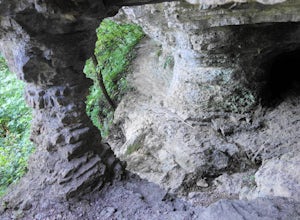
4.01 mi / 430 ft gainThe Asbury University trail system is located just south of Wilmore, KY along the lush emerald banks of the Kentucky River. Leisurely looping through the luscious limestone landmasses of the Kentucky bluegrass region, the trails at Asbury offer visitors an opportunity to obtain up-close understan...Read more -
Mammoth Cave, Kentucky
Hike or Bike Big Hollow Loop Trail
9 miThis loop trail in Mammoth Cave National Park combines a north and south loop, which are 5.3 miles and 3.7 miles, respectively. The south loop is a bit more challenging than the north loop. The trail is open to hikers, trail runners, and mountain bikers. To start out on the north loop, take the M...Read more -
Henderson, Kentucky
Hike the Wilderness Lake Trail
3.01 mi / 0 ft gainThis well kept trail is one of seven trails at John James Audubon State Park. A great short hike for the family starts at roughly 600 ft with minimal elevation change. The trail is surrounded by hardwoods and moss for the first half mile then the forest opens up to a small lake/wetlands area. The...Read more

