The Best Hiking in Garfield County
Looking for the best hiking in Garfield County? We've got you covered with the top trails, trips, hiking, backpacking, camping and more around Garfield County. The detailed guides, photos, and reviews are all submitted by the Outbound community.
Top hiking spots in and near Garfield County
-
Garfield County, Utah
Halls Creek Canyon Trail
23.14 mi / 3343 ft gainHalls Creek Canyon Trail is a loop trail where you may see local wildlife located near Hanksville, Utah.Read more -
Lake Powell, Utah
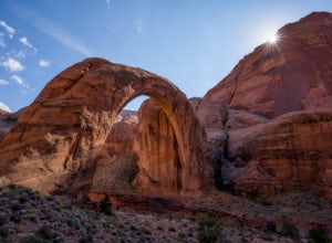
Boat-In Hike to Rainbow Bridge
1.5 miIf you need to rent a boat for this adventure, you can rent one from Lake Powell Resorts and Marina.The canyon leading into the Rainbow Bridge is located between mile markers 49-50. This is almost exactly halfway between Page and Bullfrog, making this a great trip from either marina. Plan on arou...Read more -
Lake Powell, Utah
Explore Lake Powell's Clear Creek Canyon by Powerboat
To access this adventure, you'll want to park at Bullfrog Marina. From there, you can rent a boat at the Bullfrog Marina Rentals, and head out straight from there, going south on the lake. Clear Creek Canyon lies about 2.5 miles past the entrance to the Escalante River Arm, which is located betwe...Read more -
Lake Powell, Utah
Boat-In Camp at The Rincon in Lake Powell
To get to The Rincon, you will first want to park your car and rent a boat (or bring your own power boat) at Bullfrog Marina. The marina does rentals for everything from houseboats to power boats to jet skis and kayaks/SUP boards. For this adventure, I recommend either a houseboat or a power boat...Read more -
Lake Powell, Utah
Hike to Tapestry Wall
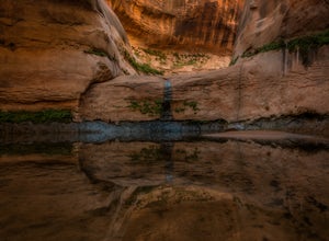
4 mi / 650 ft gainThe hike to Tapestry Wall is accessed by the waters of Lake Powell. The hike is approximately one hour each way. You will cross several huge dry pools in a gully when starting out.When the water is down more than ~50', the access for the hike is much further downstream. Cairns lead across the sli...Read more -
Lake Powell, Utah
Hike Mount Ellsworth
8 mi / 3000 ft gainJust outside of Lake Powell, this hike rewards adventurers with scenic desert views. The best recommended route is along the north ridge. There is no specific trail that takes you to the peak - utilize a GPS / map for route finding. A small antenna shack and antenna can be found on the summit. Th...Read more -
Lake Powell, Utah
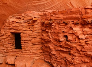
Hike to the Ancestral Puebloan Ruins in Forgotten Canyon
4 mi / 200 ft gainThe Ancestral Puebloan Ruins found up Forgotten Canyon can only be described as awe inspiring and humbling. The small adobe brick homes are known as the Defiance House. It is believed that there were a couple of families (15-20 people) who dwelled in these homes circa 1200 A.D. These ruins can ...Read more -
Torrey, Utah
Lower Muley Twist Canyon and Grand Gulch Loop
14.91 mi / 3606 ft gainLower Muley Twist Canyon and Grand Gulch Loop is a loop trail where you may see local wildlife located near Boulder, Utah.Read more -
Torrey, Utah
Headquarters Canyon Route
2.14 mi / 505 ft gainHeadquarters Canyon Route Trail is an out-and-back trail where you may see local wildlife located near Boulder, Utah.Read more -
Lake Powell, Utah
Climb Mount Holmes
7 mi / 3000 ft gainTo get up the mountain, you will pass by a sandstone wash (similar to a slot canyon), then ascend a sandstone ridge which turns into granite higher up. Route finding along the ridge is fairly easy. The entire route to the summit can be kept at only class 2, although you will probably run into som...Read more -
Torrey, Utah
Strike Valley Overlook Trail
6.28 mi / 853 ft gainStrike Valley Overlook Trail is an out-and-back trail where you may see beautiful wildflowers located near Boulder, Utah.Read more -
Garfield County, Utah
Hike in the Upper Muley Twist Canyon
4.510 mi / 750 ft gainThis hike is by far my favorite trail I've been on. To begin, you access Upper Muley Twist Canyon Road from the top of the Burr Trail Road switchbacks. Regular vehicles can be driven a little less than half a mile to the trailhead (adding about 3 miles to get to the trailhead, about 6 miles round...Read more -
Kane County, Utah
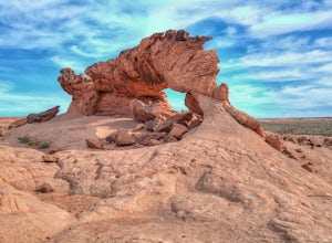
Sunrise Arch
The trailhead starts at Coyote Gulch Trailhead in the Grand Staircase - Escalante National Monument. There is actually no trail to the arches but they are pretty easy to find and even easier with a GPS. The coordinates are Sunrise Arch = 37.382214,-111.04838 and Sunset Arch = 37.38191,-111.048397...Read more -
Kane County, Utah
Day Hike Crack-in-the-Wall to Jacob Hamblin Arch in Coyote Gulch
5.011 mi / 2000 ft gainDrive to Hole in the Rock Road outside of Escalante UT. Drive SE down the all-dirt Hole in the Rock Road for 36 miles to a signed turn off on your left. The road can be sandy and bumpy from here, so consider the car you're using. Travel NE for 7 miles to the 40 Mile Ridge TH. From Here, follow a ...Read more -
Kane County, Utah
Coyote Gulch Loop
10.57 mi / 4606 ft gainCoyote Gulch Loop is a loop trail that takes you by a waterfall located near Lake Powell, Utah.Read more -
Garfield County, Utah
Little Death Hollow and Wolverine Canyon Loop
29.18 mi / 4724 ft gainLittle Death Hollow and Wolverine Canyon Loop is a loop trail that takes you by a river located near Boulder, Utah.Read more


