The Best Hiking in San Juan County
Looking for the best hiking in San Juan County? We've got you covered with the top trails, trips, hiking, backpacking, camping and more around San Juan County. The detailed guides, photos, and reviews are all submitted by the Outbound community.
Top hiking spots in and near San Juan County
-
Monticello, Utah
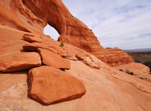
Explore Looking Glass Arch
4.0Getting there:From Moab, follow Highway 191 south for about 23 miles until you get to Looking Glass Road/Co. Rd. 131. Take a right and follow the road for about 2 miles and then turn left into the parking lot.It is only about 0.10 miles from the parking lot to the arch itself, but there is a ~150...Read more -
Monticello, Utah
Looking Glass Arch
0.52 mi / 154 ft gainLooking Glass Arch is a loop trail that takes you past scenic surroundings located near Moab, Utah.Read more -
Moab, Utah
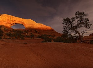
Hiking to Wilson Arch
4.3To get to Wilson Arch, drive south of Moab on US-191 S for about 25 miles. The arch is right off US-191S and there is parking on either side of the highway. Keep an eye out after you pass the LaSal Junction - the arch is visible from the road.From the parking lot there is a a very short (~0.5 mil...Read more -
Monticello, Utah
Flat Iron Mesa
13.93 mi / 755 ft gainFlat Iron Mesa is an out-and-back trail that is moderately difficult located near Moab, Utah.Read more -
Monticello, Utah
Flat Iron Mesa OHV Trail
17.42 mi / 1614 ft gainFlat Iron Mesa OHV Trail is a loop trail where you may see beautiful wildflowers located near La Sal, Utah.Read more -
Moab, Utah
Picture Frame Arch Trail
26.28 mi / 1686 ft gainPicture Frame Arch Trail is a loop trail where you may see beautiful wildflowers located near Moab, Utah.Read more -
Moab, Utah
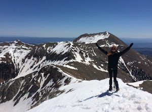
Climb Mount Tukuhnikivatz
6 mi / 2200 ft gainFrom the parking area at La Sal Pass, follow a well defined but unmapped trail though meadow, brief forest, and then switchbacks up the prominent ridge just east of the summit ridge of Mt Tuk. Once on the ridge bear west (climbers left) along the ridge as it narrows. Depending on conditions the r...Read more -
Moab, Utah
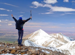
Climb Mount Peale
5.05 mi / 2721 ft gainFrom the parking area at La Sal Creek, just east of Medicine Lake examine the mountain and identify the prominent gully which feeds into La Sal Creek. Follow the old road bed north until its end and then travel cross country. Ascend the gully the the summit ridge between the northwest peak and th...Read more -
Moab, Utah
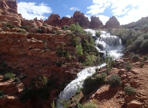
Explore Faux Falls
1 mi / 200 ft gainFaux Falls is located near the Ken's Lake campground off Route 191, 20 minutes south of Moab. When I was there it was during several days of thunderstorms. The waterfall was really gushing. Not sure how much water is running when there hasn't been rain in a while. The falls can be seen from the ...Read more -
Moab, Utah
Brumley Arch
1.8 mi / 387 ft gainBrumley Arch is an out-and-back trail that takes you by a waterfall located near La Sal, Utah.Read more -
Monticello, Utah
Camp at the Ledges Camping Area off of Kane Creek Road
5.0The turn off for Kane Creek Rd. is directly before the McDonald's on the right side of the road. A right turn takes you through small residential area and then places you on a dirt road continuing into the canyon. The road narrows a bit, switch backs, and becomes slightly rougher. Follow Kane Cr...Read more -
Moab, Utah
Clark Lake Loop Trail
2.71 mi / 673 ft gainClark Lake Loop Trail is a loop trail that takes you by a lake located near La Sal, Utah.Read more -
La Sal, Utah
Burro Pass
12.71 mi / 3045 ft gainBurro Pass is a loop trail where you may see local wildlife located near La Sal, Utah.Read more -
Moab, Utah
Gold Knob Trail
4.97 mi / 1775 ft gainGold Knob Trail is an out-and-back trail where you may see beautiful wildflowers located near Moab, Utah.Read more -
Moab, Utah
Hidden Valley to Moab Rim Trail
6.93 mi / 1066 ft gainHidden Valley to Moab Rim Trail is a point-to-point trail that takes you by a river located near Moab, Utah.Read more -
Moab, Utah
Camp in Hunters Canyon
5.02 miMoab has become an increasingly popular adventure destination over the last few years. Its proximity to Arches and Canyonlands National Parks make it a popular spot for beginning day hikers as well as seasoned canyoneers, bikers, and climbers. It comes as no surprise that it can be a hassle to fi...Read more

