The Best Hiking in Cherokee
Looking for the best hiking in Cherokee? We've got you covered with the top trails, trips, hiking, backpacking, camping and more around Cherokee. The detailed guides, photos, and reviews are all submitted by the Outbound community.
Top hiking spots in and near Cherokee
-
Cherokee, North Carolina
Oconaluftee River Trail
3.14 mi / 171 ft gainOconaluftee River Trail is an out-and-back trail that takes you by a river located near Cherokee, North Carolina.Read more -
Cherokee, North Carolina
Mingus Mill and Newton Bald Trail
10.52 mi / 3251 ft gainMingus Mill and Newton Bald Trail is a point-to-point trail where you may see beautiful wildflowers located near Cherokee, North Carolina.Read more -
Cherokee, North Carolina
Mingo Falls
4.20.22 mi / 148 ft gainAlthough it is not much of a hike at just 0.3 miles, it is accessible to people of all fitness levels. A climb up a series of stairs leads you to a trail overlooking Mingo creek. You will then find a 20 foot wide bridge which serves as the viewing platform of the falls. If you care to advent...Read more -
Cherokee, North Carolina
Smokemont Loop Trail
6.06 mi / 1627 ft gainSmokemont Loop Trail is a loop trail where you may see beautiful wildflowers located near Cherokee, North Carolina.Read more -
Bureau of Indian Affairs Highway 506, North Carolina
Barrett Knob Fire Tower
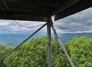
5.01.21 mi / 400 ft gainYour hike will start at the base of the Blue Ridge Parkway just a few miles from the start in Cherokee. The trail starts right off of the parkway in a very small easy to miss dirt road. There is a small area to park that then you start your hike up the dirt road right after the gate. The hike to ...Read more -
Cherokee, North Carolina
Chasteen Creek Trail
10.85 mi / 2877 ft gainChasteen Creek Trail is an out-and-back trail that takes you by a river located near Cherokee, North Carolina.Read more -
Cherokee, North Carolina
Bradley Fork Trail
8.44 mi / 1079 ft gainBradley Fork Trail is an out-and-back trail where you may see beautiful wildflowers located near Cosby, Tennessee.Read more -
Cherokee, North Carolina
Bradley Fork, Dry Sluice Gap, Appalachian, Hughes Ridge and Chasteen Creek Loop
24.03 mi / 5203 ft gainBradley Fork, Dry Sluice Gap, Appalachian, Hughes Ridge and Chasteen Creek Loop is a loop trail that takes you by a waterfall located near Cherokee, North Carolina.Read more -
Cherokee, North Carolina
Bradley Fork and Chasteen Creek Loop Trail
16.91 mi / 3579 ft gainBradley Fork and Chasteen Creek Loop Trail is a loop trail that takes you by a river located near Cherokee, North Carolina.Read more -
Bryson City, North Carolina
Deep Creek to Clingmans Dome Loop
32.82 mi / 7400 ft gainThis is a ~36 mile loop that goes up Clingman's Dome (the tallest point in Tennessee). Pretty challenging, not for the novice backpacker. Park at Deep Creek campground in Bryson City, NC. We did it as a 3-day, 2-night camping at sites 53 and 61. As it is a loop it could easily be done in reverse....Read more -
Bryson City, North Carolina
Tom Branch and Indian Creek Falls
4.51.76 miFrom the Deep Creek Trailhead, you can hike to both waterfalls heading up the Deep Creek Trail. You will come across Tom Branch Falls quickly, after 0.2 miles. Once you've had your fill of Tom Branch, head further along the Deep Creek Trail for another 0.5 miles. Turn right on the Indian Creek Tr...Read more -
Bryson City, North Carolina
Hike the Juney Whank Falls Loop
4.00.65 mi / 150 ft gainStarting at the Deep Creek Trailhead, take a short walk until the trail meets up with Juney Whank Falls Trail. From here, hang a left and head onto the Juney Whank Falls Trail. Once you've reached the falls, continue the loop to get back to the trailhead. The falls are said to be named after Mr...Read more -
Bryson City, North Carolina
Deep Creek Loop
5.05.01 mi / 892 ft gainAfter parking in the Deep Creek Campground parking lot follow the signs for the Deep Creek Trailhead. The Tom Branch waterfall is just .3 miles on the right side. Hike another .5 miles, at the next intersection stay right, and you will approach Indian Creek Falls. After viewing the falls you ca...Read more -
Bryson City, North Carolina
Deep Creek/Indian Creek Loop
13.37 mi / 2382 ft gainDeep Creek/Indian Creek Loop is a loop trail that takes you by a waterfall located near Bryson City, North Carolina.Read more -
Bryson City, North Carolina
Hike Three Waterfalls Loop
5.02.4 mi / 450 ft gainStart the loop by hiking the Juney Whank Falls Trail to Juney Whank Falls. The footbridge across the creek makes an excellent place to rest and take in the falls. Follow the trail across the bridge and up the bank. After about 300 feet take a right and follow Deep Creek Horse Trail towards Deep C...Read more -
Bryson City, North Carolina
Indian Creek and Sunkota Ridge Trail
11.71 mi / 2146 ft gainIndian Creek and Sunkota Ridge Trail is a loop trail that takes you by a waterfall located near Bryson City, North Carolina.Read more


