The Best Hiking in Connelly Springs
Looking for the best hiking in Connelly Springs? We've got you covered with the top trails, trips, hiking, backpacking, camping and more around Connelly Springs. The detailed guides, photos, and reviews are all submitted by the Outbound community.
Top hiking spots in and near Connelly Springs
-
Hickory, North Carolina
Bakers Mountain Loop Trail
2.52 mi / 574 ft gainBakers Mountain Loop Trail is a loop trail that takes you by a waterfall located near Hickory, North Carolina.Read more -
Hickory, North Carolina
Bakers Mountain Trail
2.21 mi / 531 ft gainBakers Mountain Trail is a loop trail where you may see beautiful wildflowers located near Hickory, North Carolina.Read more -
Hickory, North Carolina
Hickory Springs Loop
1.88 mi / 177 ft gainHickory Springs Loop is a loop trail that takes you by a river located near Hickory, North Carolina.Read more -
Hickory, North Carolina
Geitner Rotary Park Loop
5.02.65 mi / 354 ft gainGeitner Rotary Park Loop is a loop trail that takes you by a lake located near Hickory, North Carolina.Read more -
Connelly Springs, North Carolina
Hidden Cove Trail
2.77 mi / 932 ft gainHidden Cove Trail is an out-and-back trail that provides a good opportunity to view wildlife located near Connelly Springs, North Carolina.Read more -
Morganton, North Carolina
Catawba River Greenway
4.02 mi / 299 ft gainCatawba River Greenway is an out-and-back trail that takes you by a river located near Morganton, North Carolina.Read more -
Connelly Springs, North Carolina
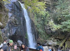
High Shoals Falls
4.52.47 mi / 617 ft gainFrom the Jacob Fork parking area in South Mountains State Park, it is a short 1 mile walk over the Jacob River to the High Shoals Waterfall (80'). If you choose to continue past the observation deck, High Shoals Falls Trail (blue circle) climbs up above the waterfall, crossing the river. Keep rig...Read more -
Connelly Springs, North Carolina
Little River to Upper CCC to Horseridge to Upper Falls Loop
11.87 mi / 1896 ft gainLittle River to Upper CCC to Horseridge to Upper Falls Loop is a loop trail where you may see local wildlife located near Connelly Springs, North Carolina.Read more -
3001 South Mountain Park, North Carolina
Shinny Creek Loop Trail
6.72 mi / 1480 ft gainShinny Creek Loop Trail is a loop trail that takes you by a river located near Connelly Springs, North Carolina.Read more -
Connelly Springs, North Carolina
Hemlock, H.Q., Upper Falls, and Fox Trail Loop
10.37 mi / 1834 ft gainHemlock, H.Q., Upper Falls, and Fox Trail Loop is a loop trail that takes you by a river located near Connelly Springs, North Carolina.Read more -
Connelly Springs, North Carolina
High Shoals Waterfall and H.Q. Loop Trail
4.83 mi / 1043 ft gainHigh Shoals Waterfall and H.Q. Loop Trail is a loop trail that takes you by a waterfall located near Connelly Springs, North Carolina.Read more -
Connelly Springs, North Carolina
Backpack to Sawtooth Campground in South Mountains SP
8.5 mi / 1500 ft gainThis 8.5-mile total trip will take you through the highlights of South Mountains State Park with an overnight stay in one of the drier campsites. You'll start with a 2.7 mile loop that you can do sans packs before picking up with a 3-mile each way out-and-back. Begin by parking at the large par...Read more -
Connelly Springs, North Carolina
River to Chestnut Knob to Sawtooth Loop
7.56 mi / 1306 ft gainRiver to Chestnut Knob to Sawtooth Loop is a loop trail where you may see beautiful wildflowers located near Connelly Springs, North Carolina.Read more -
Connelly Springs, North Carolina
Hiking the South Mountains' Jacob Fork
4.0The journey begins at the Cicero Branch Parking Area along South Mountain Road, following Jacob Fork River Trail. The trail runs along the Fork before ascending Chestnut Knob. After completing the trail, you will find yourself on the highest peak of the South Mountain chain, where there are breat...Read more -
Lenoir, North Carolina
Lenoir Greenway
3.86 mi / 407 ft gainLenoir Greenway is a loop trail that takes you by a river located near Lenoir, North Carolina.Read more -
Conover, North Carolina
Riverbend Park Red Trail
3.6 mi / 279 ft gainRiverbend Park Red Trail is a loop trail that takes you by a river located near Claremont, North Carolina.Read more


