The Best Hiking in Sylva
Looking for the best hiking in Sylva? We've got you covered with the top trails, trips, hiking, backpacking, camping and more around Sylva. The detailed guides, photos, and reviews are all submitted by the Outbound community.
Top hiking spots in and near Sylva
-
Sylva, North Carolina
Black Rock Mountain via Fisher Creek
7.07 mi / 3264 ft gainBlack Rock Mountain via Fisher Creek is an out-and-back trail that takes you through a nice forest located near Sylva, North Carolina.Read more -
Sylva, North Carolina
Pinnacle in Pinnacle Park
5.05.98 mi / 2142 ft gainHeading out from the parking area, head north on this challenging hike. For the majority of the hike, you'll have a pretty steady uphill charge. There are some flat parts between climbs, so be sure to catch your breath and get some water in during these times. Once you reach the fork, where you'...Read more -
Sylva, North Carolina
The Pinnacle Trail
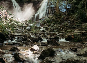
7.46 mi / 2802 ft gainThe Pinnacle Trail is a loop trail that takes you by a waterfall located near Sylva, North Carolina.Read more -
Cullowhee, North Carolina
Cullowhee Connector (Yellow Blazes)
2.93 mi / 525 ft gainCullowhee Connector (Yellow Blazes) is an out-and-back trail that takes you through a nice forest located near Cullowhee, North Carolina.Read more -
Sylva, North Carolina
Hike to Cowee Bald Fire Tower
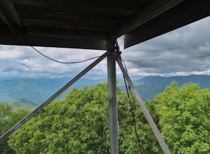
4.4 mi / 400 ft gainThe Cowee Bald Fire Tower is located in the Nantahala National Forest near Bryson City North Carolina. To get there you can either drive almost all the way to the top about .2 miles from the top but to get there you will need to have a 4WD or a higher clearance vehicle to cross a small stream. Ho...Read more -
Sylva, North Carolina
Blackrock Mountain and The Pinnacle
10.38 mi / 2894 ft gainBlackrock Mountain and The Pinnacle is an out-and-back trail where you may see beautiful wildflowers located near Sylva, North Carolina.Read more -
Sylva, North Carolina
Blackrock Mountain Trail
4.94 mi / 541 ft gainBlackrock Mountain Trail is an out-and-back trail where you may see beautiful wildflowers located near Sylva, North Carolina.Read more -
Sylva, North Carolina
Waterrock Knob Trail
5.01 mi / 407 ft gainThe trail begins paved and quickly climbs up into a heavily forested area. Once at a 1/4 of a mile in, you will come to a nice overlook that will give you your first real good view of the surrounding mountains. The trail then continues on, though now unpaved, with great views off to your left as ...Read more -
Sylva, North Carolina
Abandoned Cessna 414A at Waterrock Knob
5.01.72 mi / 430 ft gainThis is an AWESOME day hike for anyone looking to get outside for a few hours and see some special views of the blue ridges, as well as check out the abandoned plane crash of a Cessna 414A that happened back in 1983. The remains of the plane are still scattered along the hillside making it a supe...Read more -
Cullowhee, North Carolina
Exploring two legendary Cherokee sites: Judaculla Rock and Devil's Courthouse, North Carolina
0.9 mi / 258 ft gainJudaculla was an ancient Cherokee spirit being and giant. He ruled in western North Carolina in the traditional Cherokee homeland. Once while chasing some hunters, when he jumped to the ground, his hand hit a rock. You can still see the print on Judaculla Rock. It is the most elaborate piece of r...Read more -
Sylva, North Carolina
Fort Ridge Overlook to Waterrock Knob
5.36 mi / 1352 ft gainFort Ridge Overlook to Waterrock Knob is an out-and-back trail where you may see beautiful wildflowers located near Sylva, North Carolina.Read more -
Maggie Valley, North Carolina
Soco Falls
5.00.09 mi / 0 ft gainThis double waterfall is located a mile and half off of the Blue Ridge Parkway in the Cherokee Indian Reservation. From the parking area, it's a short walk down a well-established trail to the viewing area of the falls. For an even closer view of the falls, you can follow a roped, steep path dow...Read more -
Bryson City, North Carolina
Hike to Alarka Falls
5.01 mi / 100 ft gainTo visit the falls, take US-74 west from Bryson City to exit 64 . Take a left at the exit and drive on Alarka Road for about 10 miles. Follow the road all the way to the end where you will find a turnaround. Don't make the mistake of following the forest service road (it is gated), as it is not ...Read more -
Bureau of Indian Affairs Highway 506, North Carolina
Barrett Knob Fire Tower
5.01.21 mi / 400 ft gainYour hike will start at the base of the Blue Ridge Parkway just a few miles from the start in Cherokee. The trail starts right off of the parkway in a very small easy to miss dirt road. There is a small area to park that then you start your hike up the dirt road right after the gate. The hike to ...Read more -
Waynesville, North Carolina
Grassy Ridge Mine Overlook
1.14 mi / 151 ft gainGrassy Ridge Mine Overlook is an out-and-back trail where you may see beautiful wildflowers located near Balsam, North Carolina.Read more -
Cherokee, North Carolina
Oconaluftee River Trail
3.14 mi / 171 ft gainOconaluftee River Trail is an out-and-back trail that takes you by a river located near Cherokee, North Carolina.Read more


