The Best Hiking in Bandera
Looking for the best hiking in Bandera? We've got you covered with the top trails, trips, hiking, backpacking, camping and more around Bandera. The detailed guides, photos, and reviews are all submitted by the Outbound community.
Top hiking spots in and near Bandera
-
Bandera, Texas
Hike Cougar Canyon to Hermit's Trace Loop
7.32 mi / 656 ft gainHike in the designated area up the road from the Bandera State Nature Area border (see map). Trail is accessible from March to October and is dog-friendly. The trails are well marked and fairly well maintained. Directions from Bandera, TX: Travel south on State Highway 173, go across the Medina...Read more -
Bandera, Texas
Hike Spring Branch And Wilderness Trail
7.4 mi / 908 ft gainSpring Branch and Wilderness Trail is a 7.4 mile loop hike where you may see local wildlife located near Tarpley, TX.Read more -
Bandera, Texas
Hike the Wilderness Trail to Bandera Creek Trail
6.68 mi / 580 ft gainThe trail is moderately strenuous, and is best used from September to June. Dogs are able to use this trail, but must be kept on leash.Read more -
Bandera, Texas
Hike Boyles Bump And 24 Creek Bottom Loop Trail
9.2 mi / 1 ft gainBoyles Bump and 24 Creek Bottom Loop Trail is a 9.1 mile loop hike where you may see beautiful wild flowers located near Bandera, TX.Read more -
Bandera, Texas
Hike Wilderness And Twin Peaks Trails
3.7 mi / 492 ft gainWilderness and Twin Peaks Trails is a 3.7 mile loop hike where you may see local wildlife located near Tarpley, TX.Read more -
Bandera, Texas
Hike Praire Loop #2b Trail
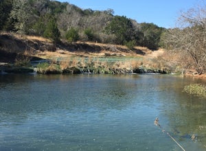
2.9 mi / 147 ft gainPraire Loop #2B Trail is a 2.17 mile loop hike that takes you by a river located near Bandera, TX.Read more -
Bandera, Texas
Hike Wilderness And Spring Branch Trail Loop
5.6 mi / 649 ft gainWilderness and Spring Branch Trail Loop is a 5.59 mile loop hike where you may see local wildlife located near Tarpley, TX.Read more -
29.634257,-99.185765
West Peak Loop
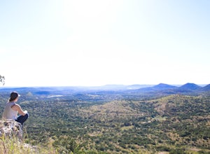
4.02.4 mi / 1000 ft gainWest Peak is situated in the beautiful Hill Country State Natural Area which is located near the popular Lost Maples and Garner state parks. The scenic overlook located on this peak gives an unparalleled view of the Hill Country Valley and definitely worth the hike if you're in the area. Once you...Read more -
Bandera, Texas
Hike the Medina Loop
5 mi / 1800 ft gainThe Photos as seen above are from the Medina Loop hike. I'll preface by saying that this isn't the hike I went to the park for, yet I'm incredibly satisfied with the experience. The Medina loop had everything you'd want in a hike. Mixed terrains, wildlife to watch, and glimpses of expansive v...Read more -
Bandera, Texas
Hike 8 Hightower And 98 Eagle Loop
7.4 mi / 610 ft gain8 Hightower and 98 Eagle Loop is a 7.4 mile loop hike that takes you by a river located near Tarpley, TX.Read more -
Bandera, Texas
Hike the Hightower Loop
4.08 mi / 357 ft gainThis is a great hike for wildlife viewing! There have been reports of javelinas at the top of the trail. Remember - don't approach any wildlife. The trail is also open for mountain biking and horseback riding. The Hightower Loop is near Tarpley, Texas. The trail is best used from September until ...Read more -
Medina, Texas
Hike Medina To Garner State Park Scenic Drive
45.7 mi / 2 ft gainMedina to Garner State Park Scenic Drive is a 45.67 mile point-to-point hike that takes you past scenic views located near Medina, TX.Read more -
Kerrville, Texas
Hike Kerrville Schreiner Yellow, Orange, Green, Red, And Teal Loop
7 mi / 380 ft gainKerrville-Schreiner Yellow, Orange, Green, Red, and Teal Loop is a 7 mile loop hike that takes you past great forest setting located near Kerrville, TX.Read more -
Kerrville, Texas
Hike Kerrville Schreiner Teal Trail And Road Loop
1.8 mi / 98 ft gainKerrville-Schreiner Teal Trail and Road Loop is a 1.9 mile loop hike that takes you past scenic views located near Kerrville, TX.Read more -
Kerrville, Texas
Hike the Kerrville - Schreiner Park Trail
3.08 mi / 203 ft gainThe trail is good for all skill levels and primarily used for hiking, walking, and mountain biking. Directions from Kerrville, TX: Travel 3 miles southeast of Kerrville on State Highway 16 to State Highway 173 for 3 miles. The park headquarters building is on the left.Read more -
Kerrville, Texas
Hike Kerrville River Trail
7 mi / 114 ft gainKerrville River Trail is a 7 mile out and back hike that takes you by a river located near Kerrville, TX.Read more


