The Best Hiking in Concan
Looking for the best hiking in Concan? We've got you covered with the top trails, trips, hiking, backpacking, camping and more around Concan. The detailed guides, photos, and reviews are all submitted by the Outbound community.
Top hiking spots in and near Concan
-
Concan, Texas
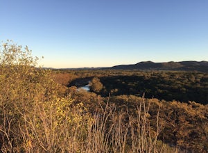
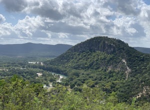
Ol' Baldy, Bird, Bridges, Madrone Loop
5.02.77 mi / 938 ft gainGarner State Park is one of the best parks in Texas Hill Country if you are looking for some hiking with elevation. It is incredibly scenic, has plenty of campgrounds, and is also nearby to Lost Maples State Natural Area - a park very well-known for its fall foliage. If you happen to visit Garner...Read more -
Concan, Texas
Hike Bird Trail and Bridges Trail
1.5 mi / 464 ft gainPark off of State Park Road 29 (see map) to access the trailhead. Trail is accessible from March until October and allows dogs on leash.Read more -
Concan, Texas
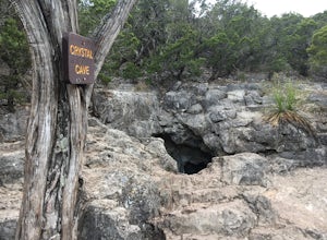
Crystal Cave via Horseshoe Canyon And Bridges Trail Loop
1.52 mi / 413 ft gainCrystal Cave via Horseshoe Canyon and Bridges Trail Loop is a loop trail where you may see local wildlife located near Concan, TX.Read more -
Concan, Texas
Crystal Cave via Foshee and Old Horse Trail
5.02.55 mi / 499 ft gainCrystal Cave via Foshee and Old Horse Trail is a loop trail that takes you past a cave located near Rio Frio, TX.Read more -
Concan, Texas
Hike Highway And Mountain Bike Trail Loop
5.8 mi / 702 ft gainHighway and Mountain Bike Trail Loop is a 5.8 mile loop hike that takes you by a river located near Concan, TX.Read more -
Concan, Texas
Hike Old Entrance Road, Old Horse And Foshee Trail Loop
2.4 mi / 495 ft gainOld Entrance Road, Old Horse and Foshee Trail Loop is a 2.4 mile loop hike that takes you by a river located near Concan, TX.Read more -
Concan, Texas
Hike Wild Horse Creek And Old Entrance Road Loop
1.8 mi / 193 ft gainWild Horse Creek and Old Entrance Road Loop is a 1.8 mile loop hike that takes you past great forest setting located near Concan, TX.Read more -
Concan, Texas
Hike Foshee Trail, Highway, And Old Entrance Road Trails Loop
4.8 mi / 603 ft gainFoshee Trail, Highway, and Old Entrance Road Trails Loop is a 4.8 mile loop hike that takes you by a river located near Concan, TX.Read more -
Concan, Texas
Hike Wild Horse Creek, Highway, And Campos Trail Loop
3.3 mi / 508 ft gainWild Horse Creek, Highway, and Campos Trail Loop is a 3.3 mile loop hike where you may see local wildlife located near Concan, TX.Read more -
Concan, Texas
Hike Frio Canyon Trail
3.3 mi / 111 ft gainFrio Canyon Trail is a 3.3 mile loop hike that takes you past great forest setting located near Concan, TX.Read more -
Concan, Texas
Mountain Bike, Foshee And Highway Trail Loop
7.1 mi / 807 ft gainMountain Bike, Foshee and Highway Trail Loop is a 7.1 mile loop hike that takes you by a river located near Concan, TX.Read more -
Utopia, Texas
Camp out at Four Sisters Ranch Cabin
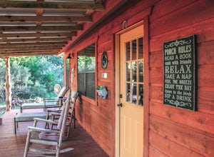
4.0If you're looking for a beautiful secluded cabin to camp in the Texas Hill Country make sure to check out Four Sisters Ranch Cabin. Located near Vanderpool and Utopia, this cabin is the perfect place for a weekend getaway. The landowners are gracious hosts that bake banana nut bread for you and d...Read more -
Vanderpool, Texas
Hike the Lost Maples Extra Loop Trail
7.1 mi / 930 ft gainThe Lost Maples Extra Loop Trail is 7.1 loop hike that loops around the majority of the park. It is highly trafficked and offers stunning views of the Texas Hill Country landscape. Please be advised that there are several challenging inclines and steep portions of the trail, so hiking shoes and p...Read more -
Vanderpool, Texas
Hike the Lost Maples West Trail Loop
4.07 mi / 849 ft gainThe Lost Maples West Trail Loop is a 7 mile loop hike that loops around the west portion of Lost Maples State Park. This trail is mostly shaded and offers gorgeous views and scenic overlooks. There are areas for swimming, if desired. Please be advised that there are steep areas and challenging in...Read more -
Vanderpool, Texas
Hike Lost Maples Flats
5.85 mi / 528 ft gainStart the route by walking back to picnic ground entrance, crossing Can Creek where it flows into the Sabinal River, then going up Can Creek to the dam and "The Pond", reverse direction at The Pond and backtrack to the picnic ground startpoint. Then continue on to the East Trail trailhead and fol...Read more -
Vanderpool, Texas
Primitive Camp at Lost Maples State Natural Area
4.02.5 mi / 849 ft gainStart at the day use overflow parking lot, there is a picnic area and a paved road will lead you to the trailhead for the East and West Trail Loops. Continue along, following the signs to the West Trail Loop. You'll come across little river crossings, but much of the trail is rocky with a nice g...Read more

