The Best Hiking in Marble Falls
Looking for the best hiking in Marble Falls? We've got you covered with the top trails, trips, hiking, backpacking, camping and more around Marble Falls. The detailed guides, photos, and reviews are all submitted by the Outbound community.
Top hiking spots in and near Marble Falls
-
Marble Falls, Texas
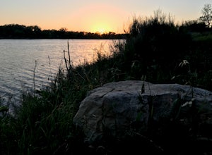
Camp at Shaffer Bend Recreation Area
6 mi / 80 ft gainAfter turning off Highway 1431 you'll drive through a little quiet and narrow one road neighborhood to arrive at the entrance to Shaffer Bend Recreation Area. From there you will drive down a dirt road which will take you almost all the way through Shaffer Bend's 523 acre lot, and lead you direct...Read more -
Marble Falls, Texas
Hike Hidden Falls Ohv Loop
12 mi / 928 ft gainHidden Falls OHV Loop is a 12 mile loop hike that is accessible year round located near Marble Falls, TX.Read more -
Marble Falls, Texas
Hike Park Rd 1, North Pole, And Park Rd 2 Ohv Loop
5.1 mi / 564 ft gainPark Rd 1, North Pole, and Park Rd 2 OHV Loop is a 5.1 mile loop hike that takes you past scenic views located near Marble Falls, TX.Read more -
Marble Falls, Texas
Hike Hidden Falls Adventure Park Ohv Loop
6.2 mi / 918 ft gainHidden Falls Adventure Park OHV Loop is a 6.21 mile point-to-point hike that is accessible year round located near Marble Falls, TX.Read more -
Burnet, Texas
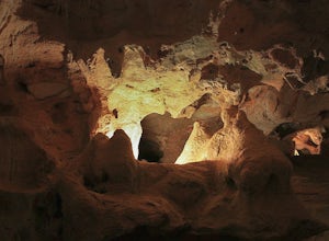
Tour the Longhorn Caverns
5.01.1 miThe Longhorn Cavern State Park is a hidden gem in the Hill Country. The caverns are breathtaking and some of the walls are completely covered in Quartz. During prohibition, bootleggers used the caverns as a speakeasy and there are remnants left from that era. In order to view the Caverns you must...Read more -
Spicewood, Texas
Hike Grelle Recreation Area Loop Trail
2.2 mi / 246 ft gainGrelle Recreation Area Loop Trail is a 2.2 mile loop hike that's dog-friendly located near Spicewood, TX.Read more -
Spicewood, Texas
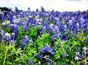
Hike through Muleshoe Bend Recreation Area
5.05.4 mi / 365 ft gainSpend all day wandering the endless fields of bluebonnets above the banks of the Colorado River in this hill country oasis. MuleshoeBend Recreation Area is just 50 minutes outside of Austin in Spicewood, TX. It has 540 acres of trails, camping, and picnic tables. The highlight of this park is the...Read more -
Marble Falls, Texas
Hike Creek Trail To Mountain Road Loop
0.7 mi / 62 ft gainCreek Trail to Mountain Road Loop is a 0.7 mile loop hike that takes you by a waterfall located near Bertram, TX.Read more -
Bertram, Texas
Hike the Rim Rock Loop Trail
1.78 mi / 209 ft gainThe Rim Rock Loop Trail is shared by hikers, trail runners, and groups on nature trips. The trail is open year-round, but is best trafficked in the fall - spring to avoid the hot summer sun. The Rim Rock Trail is family friendly, but does not allow dogs.Read more -
Marble Falls, Texas
Hike Balcones Canyonlands Indiangrass Trail
3.6 mi / 528 ft gainBalcones Canyonlands Indiangrass Trail is a 3.6 mile loop hike that takes you by a waterfall located near Marble Falls, TX.Read more -
Burnet, Texas
Camp at Inks Lake's Pecan Flats
5.02 miInks Lake is located northwest of Austin and is home to about 200 campsites. For a more unique experience and to be set away from the parks many visitors, choose the Pecan Flats Trail Primitive Camp which is about a mile hike from the Pecan Flats trailhead.Once you enter the park, the Pecan Flats...Read more -
Burnet, Texas
Hike the Inks Lake State Park Trail
4.04.7 mi / 347 ft gainThe Inks Lake State Park Trail is a 4.7 mile loop trail located within Inks Lake State Park, just outside of Burnet, Texas. Only a small portion of the trail follows the lake, then it veers off through the rocky and hilly terrain of the Texas Hill Country. The trail is only partially shaded at ti...Read more -
Johnson City, Texas
Explore Pedernales Falls
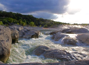
4.80.6 mi / 104 ft gainPedernales Falls drops 50 feet in elevation over 3,000 feet of titled, layered steps of limestone along the Pedernales River in Blanco County. In order to reach the falls you must enter Pedernales Falls State Park and follow the park road until the very end. There you'll find a parking lot and it...Read more -
Spicewood, Texas
Camp at Pace Bend Park
4.4Pace Bend is a favorite camping and day use destination near Austin, Texas. The park is approximately 45 minutes West of Austin located off of Hwy 71 and offers visitors a wide range of recreational activities. There is an entrance fee of $10 per vehicle for Day Use only and $15 per vehicle for p...Read more -
Spicewood, Texas
Climb at Pace Bend Park
The "must have" campsite is along Marshall Cove in Pace Bend Park. From the park's entrance head straight along the road and take the 3rd left onto the Marshall Cove turnout. The sites are not numbered, but locating the site is pretty easy--it's on the left-hand side of the the road along the edg...Read more -
Dripping Springs, Texas
Hike Reimers Canyon And River Multi Use Trail
5.3 mi / 344 ft gainReimers Canyon and River Multi Use Trail is a 5.3 mile loop hike that takes you by a river located near Dripping Springs, TX.Read more

