The Best Hiking in Deming
Looking for the best hiking in Deming? We've got you covered with the top trails, trips, hiking, backpacking, camping and more around Deming. The detailed guides, photos, and reviews are all submitted by the Outbound community.
Top hiking spots in and near Deming
-
Deming, Washington
Hike to Racehorse Falls
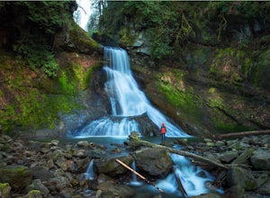
3.7Racehorse Creek is broken up into four distinct waterfalls that drop a total of 140ft through a relatively shallow gorge. The first two waterfalls are punchbowl-type falls that have deep holes at their bases. Immediately below the second waterfall, the creek descends rapidly before it arrives at...Read more -
Bellingham, Washington
Stimpson Nature Preserve
3.08 mi / 459 ft gainStimpson Nature Preserve is a loop trail that takes you by a lake located near Bellingham, Washington.Read more -
Bellingham, Washington
Whatcom Creek Trail Loop
4.12 mi / 427 ft gainWhatcom Creek Trail Loop is a loop trail that takes you by a waterfall located near Bellingham, Washington.Read more -
Bellingham, Washington
Squires Lake Trail
1.45 mi / 292 ft gainSquires Lake Trail is a loop trail that is good for all skill levels located near Bellingham, Washington.Read more -
Bellingham, Washington
Hike Around Squires Lake
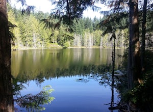
3.02 mi / 200 ft gainThis short, easy loop around the water makes for a peaceful afternoon excursion, or a family-friendly outing. At the first fork in the trail, turn left to reach views of the dam, a waterfall, and the lake. Also keep an eye out for a side trail leading to Beaver Pond. There are often wildflowers a...Read more -
Bellingham, Washington
Hike to Pine & Cedar Lakes
5.05 mi / 1400 ft gainThese two quaint lakes in the Chuckanuts are a must-do for people looking for a day hike, short camping trip or steep trail run in the Bellingham area. Starting at the trailhead off of Old Samish Road, one begins the 2 mile ascent to the two lakes. The first 1,400ft climb has its fair share of up...Read more -
Deming, Washington
Hike Helitrope Ridge
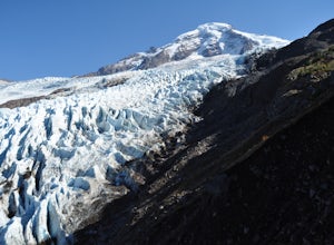
4.75.5 mi / 1500 ft gainStarting at the marked Heliotrope Ridge parking lot of FS Road 39, just 8 miles out of the quaint town of Glacier, Washington, you begin your ascent to the glacier viewpoint. The trailhead sign indicates that it is a strenuous 2,000 ft gain over 2.5 miles up to the overlook.This clearly cut trail...Read more -
Deming, Washington
Hike the Horseshoe Bend Trail
4.06 mi / 210 ft gainLocated just outside the town of Glacier, WA and 40 minutes prior to Mount Baker Ski area, sits the Horseshoe Bend Trail. A simple and straightforward 6 mile out and back route. To get here, take Hwy 542 towards the direction of Mount Baker. About 4 miles after you pass through the town of Glacie...Read more -
Bellingham, Washington
South Bay Trail
4.96 mi / 138 ft gainSouth Bay Trail is an out-and-back trail that provides a good opportunity to view wildlife located near Bellingham, Washington.Read more -
Bellingham, Washington
Teddy Bear Cove via Interurban Trail
1.59 mi / 427 ft gainTeddy Bear Cove via Interurban Trail is a loop trail that takes you by a lake located near Bellingham, Washington.Read more -
Deming, Washington
Hike Skyline Divide
5.09 mi / 2500 ft gainIf driving 13 miles on a forest road, and hiking miles of switchbacks doesn't bother you, your in for one of the most exquisite views that you can get from hiking in Washington state.Just a mile outside of the town of Glacier, turn onto Forest Road 37 and follow it up switchbacks for the majority...Read more -
Ferndale, Washington
Take a Stroll through Hovander Homestead Park
5.01.4 mi / 0 ft gainDriving up to the park entrance: take a right to drive towards the barnyards, playgrounds, covered picnic areas, historic house and community gardens, and access to the Snoqualmie River. Or, drive straight and park outside of the fragrance gardens and historic house/ museum, and take a walk to a...Read more -
Bellingham, Washington
Hike to Fragrance Lake
4.75.5 mi / 950 ft gainTake Chuckanut Drive to the trailhead which is located directly across from the entrance to Larrabee State Park. A small lot in front of the trail has space for 8-10 cars, or you can park at the State Park and walk across the road (carefully!) to reach the trailhead. Either way you will need a Di...Read more -
Bellingham, Washington
South Lost Lake Trail
10.04 mi / 2657 ft gainSouth Lost Lake Trail is a loop trail that takes you by a lake located near Bow, Washington.Read more -
Deming, Washington
Summit Church Mountain
8.5 mi / 3750 ft gainStart by driving roughly 2.5 miles up Forest Road 3040, conveniently named E Church Mt Road, to the trailhead. The road is bumpy, but lacking the pot-holes that occupy many of the other forest roads. The only issue comes at 2 miles in where a stream runs over the road and has eroded a small ditch...Read more -
Bow, Washington
Hike to Oyster Dome
4.36.5 mi / 1900 ft gainThe trail begins on the Pacific Northwest Trail, which ascends quickly up the side of Blanchard Mountain. The trail contains several switchbacks which wind through second-growth alder, Western red cedar, and Douglas fir forest. After about one mile there is an overlook with a bench that offers a ...Read more

