The Best Hiking in Randle
Looking for the best hiking in Randle? We've got you covered with the top trails, trips, hiking, backpacking, camping and more around Randle. The detailed guides, photos, and reviews are all submitted by the Outbound community.
Top hiking spots in and near Randle
-
Randle, Washington
Woods Creek Watchable Wildlife Trail
0.96 mi / 75 ft gainWoods Creek Watchable Wildlife Trail is a loop trail where you may see local wildlife located near Randle, Washington.Read more -
Randle, Washington
Hike to High Rock Lookout
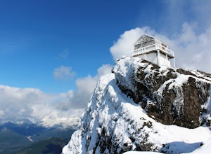
5.03.2 mi / 1365 ft gainHigh Rock Lookout is aptly named. Perched at 5,685' on a slab of rock, it has sweeping views of the valleys below, Cora Lake, and Mount Rainier. Although it is only a short 1.6 mile hike to the top, it is a steep one. You gain 1,365' to reach the lookout, but the reward is grand.The trail follows...Read more -
Ashford, Washington
Teeley Creek Trail #251 to Bertha May Lake
2.01 mi / 833 ft gainTeeley Creek Trail #251 to Bertha May Lake is an out-and-back trail where you may see beautiful wildflowers located near Packwood, Washington.Read more -
Glenoma, Washington
Vanson Peak Trail Via Goat Creek Trail Loop
13.05 mi / 4016 ft gainVanson Peak Trail Via Goat Creek Trail Loop is a loop trail that takes you by a waterfall located near Mossyrock, Washington.Read more -
Randle, Washington
South Point Trail
6.97 mi / 3317 ft gainSouth Point Trail is an out-and-back trail where you may see beautiful wildflowers located near Randle, Washington.Read more -
Packwood, Washington
Hike and Fish the Tatoosh Lakes
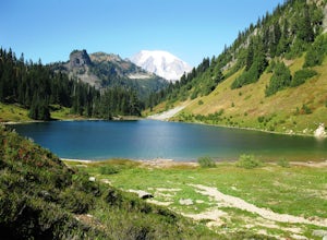
7 miLocated just south of Mountain Rainier National Park, Tatoosh Lakes and Tatoosh Wilderness area are a great hiking destination to find scenic views, wildflowers, wildlife, and two beautiful alpine lakes.Tatoosh Trail #161 does not waste any time getting down to business as it ascends almost 3000 ...Read more -
Ashford, Washington
Hike Kautz Creek to Indian Henry's Hunting Ground
11 mi / 2520 ft gainNamed after the Native American who lived here prior to Mt. Rainier becoming a national park, So-To-Lick's was dubbed "Indian Henry" by the postman who unfortunately did not learn his name. When heading out on this hike, keep an eye on the weather in Mt. Rainier National Park. If hiking this trai...Read more -
Ashford, Washington
Twin Firs Loop Trail
0.41 mi / 157 ft gainTwin Firs Loop Trail is a loop trail where you may see local wildlife located near Longmire, Washington.Read more -
Ashford, Washington
Snowshoe or Ski to Mt. Tahoma High Hut
5.04.5 mi / 2400 ft gainMake the 3.2 - 4.5 mile hike up groomed trails to the Mt Tahoma High Hut (4750 feet) for the perfect winter getaway. Spend the day outside sledding, skiing, snowshoeing and playing in the snow with a spectacular view of Mount Rainier, Mount Adams, and Mount St. Helens. Afterwards go inside and en...Read more -
Packwood, Washington
Eagle Peak Trail
6.95 mi / 2907 ft gainEagle Peak Trail is an out-and-back trail that takes you through a nice forest located near Longmire, Washington.Read more -
Ashford, Washington
Hike the Rampart Ridge Trail to Wonderland Trail Loop
6 mi / 1870 ft gainThis is a wonderful loop to do that avoids some of the crowds on the flatter trails and gives you an amazing view of the mountain. Park in the Longmire parking lot where the National Park Inn and Longmire Museum are. Walk across Paradise Rd E to join up with the Trail of the Shadows. Head north o...Read more -
Ashford, Washington
Snowshoe to Longmire Lookout
4.1 mi / 800 ft gainStarting at the Longmire Trailhead, cross the road and begin snowshoeing counter-clockwise on the Trail of Shadows. This first 0.5 miles begins the hike as a nice warm up where you can make sure your snowshoes are adjusted properly and stop from time to time to learn some facts from the interpre...Read more -
Randle, Washington
Hike to Packwood Lake
9.2 mi / 1535 ft gainThis is a relatively tame hike through the beautiful Gifford Pinchot National Forest, winding to the Goat Rocks Wilderness. With only 600 feet of elevation gain over 4.6 miles in, I would recommend it for hiking or trail running. Keep in mind this trail is open to horses and other stock so you ma...Read more -
Packwood, Washington
Tatoosh Ridge Trail
10.74 mi / 4170 ft gainTatoosh Ridge Trail is an out-and-back trail where you may see beautiful wildflowers located near Paradise Inn, Washington.Read more -
Packwood, Washington
Hike Tatoosh Ridge from Tatoosh Trail #161
12 mi / 4100 ft gainAt the trailhead kiosk be sure to get one of the provided (and required) self-serve Wilderness Permit. Starting at the trailhead begin your initial accent following the marked trail on the side of the road. In the first two 2.5 miles you will climb 2,745 feet, it's hard but luckily a majority of ...Read more -
Skamania County, Washington
Hike to Norway Pass
4.4 mi / 860 ft gainJust 96 miles south of Seattle, and 50 miles northeast of Portland, Mt. St. Helens and its wild, rugged beauty awaits you.Starting at the Norway Pass Trailhead parking lot, walk a dusty and sometimes ashy trail through recovering forest, low brush, wildflowers and blown down, sun bleached logs. T...Read more


