The Best Hiking in Brinnon
Looking for the best hiking in Brinnon? We've got you covered with the top trails, trips, hiking, backpacking, camping and more around Brinnon. The detailed guides, photos, and reviews are all submitted by the Outbound community.
Top hiking spots in and near Brinnon
-
Seabeck, Washington
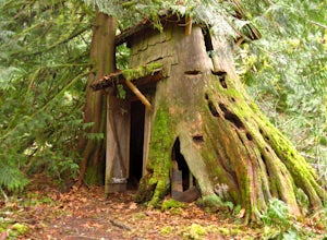
Hike to Guillemont Cove Stump House
4.52.5 miHave you ever been inside a stump house? This is your chance! Just outside of Seabeck, Washington lies a hobbit stump house tucked into a mossy forest on the shores of Guillemont Cove. Drive to Seabeck, turn right onto Miami Beach Road, bear left onto Stavis Bay road and continue for 4.5 miles...Read more -
National Forest Development Road 2530, Washington
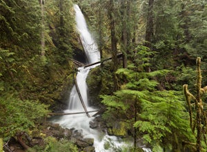
Hike to Murhut Falls
1.37 mi / 371 ft gainThe trailhead to Murhut Falls is located about 7.5 miles off US-101 S but the last couple of miles are on NF-2530 which can be potholed and rutted. I made it up the road in my 2WD sedan but it took quite some time to dodge all of the potholes. This hike is nice and quick! It starts with a small ...Read more -
Brinnon, Washington
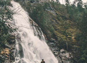
Short Hike to Rocky Brook Falls
4.80.25 miTo find the falls, head north up Hwy. 101 past Brinnon, Washington and hang a left at Dosewallips Rd. Keep an eye on the mile markers. Right after mile three and crossing a small bridge, there's a parking area on the left side enough for about 6 cars. The hike to Rocky Brook Falls is a short one ...Read more -
Bremerton, Washington
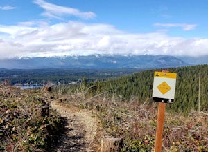
Hike the Gold Creek Trail at Green Mountain
4.05 mi / 1000 ft gainThe Gold Creek Trail is one of several trails in the Green Mountain region. Although the trail is intertwined with others, it is almost impossible to start down the wrong path. The trail is well-marked and well-maintained, making this an excellent option for the family. The trail begins at the e...Read more -
Bremerton, Washington
Tin Mine Trail and Davis Trail Loop
4.9 mi / 640 ft gainTin Mine Trail and Davis Trail Loop is a loop trail where you may see beautiful wildflowers located near Bremerton, Washington.Read more -
Brinnon, Washington
Camp at the Dose Forks
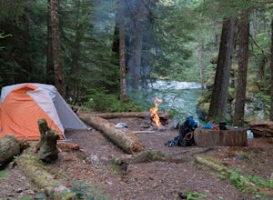
15 mi / 1200 ft gainThe Dose Forks Campground is an overlooked campsite deep within the Olympic National Park, making it a perfect weekend camping destination. A mild, 7.5 mile (one-way) trail delivers you to this enchanting area and is a must for those who love photographing forests. There are no reservation requir...Read more -
Brinnon, Washington
Main Fork Dosewallips River Trail
41.45 mi / 7618 ft gainMain Fork Dosewallips River Trail is an out-and-back trail that takes you by a lake located near Brinnon, Washington.Read more -
Brinnon, Washington
Dosewallips River Road Trail
12.51 mi / 1434 ft gainDosewallips River Road Trail is an out-and-back trail that takes you by a waterfall located near Brinnon, Washington.Read more -
Brinnon, Washington
Doseweallips Road to Constance Pass Trail
34.02 mi / 8816 ft gainDoseweallips Road to Constance Pass Trail is an out-and-back trail that takes you by a lake located near Brinnon, Washington.Read more -
Brinnon, Washington
West Fork Dosewallips River Trail
32.86 mi / 5820 ft gainWest Fork Dosewallips River Trail is an out-and-back trail that takes you by a waterfall located near Brinnon, Washington.Read more -
Mason County, Washington
Hike to Lena Lake
4.55 mi / 1300 ft gainThe trail climbs gently up and is accessible almost every season, weather permitting. Snow shoes may be needed December-February, so make sure and check with the Hoodsport Ranger Station.Just 45 minutes north of Hoodsport (a darling small town on the shores of Puget Sound), this trailhead has spa...Read more -
Mason County, Washington
Climb the Brothers (South Climb)
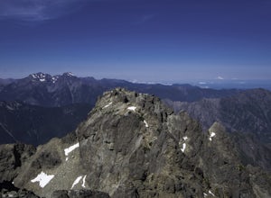
4.517 mi / 6062 ft gainThe Brothers is a notable peak on the border of Olympic National Park. The dual summits are a distinguishing feature of the Olympic Range, viewed from Seattle. This is a challenging route, testing a climber's route finding skills, physical fitness, and mental fortitude. From the parking lot, you ...Read more -
Mason County, Washington
Upper Lena Lake
5.012.61 mi / 4239 ft gainThe hike to Upper Lena Lake is a beautiful one. It first takes you past Lena Lake, which is a very popular weekend destination for families. Luckily you're pushing on to Upper Lena Lake that sits in a peaceful alpine meadow with Mt. Lena and Mt. Bretherton towering above. The first part of the t...Read more -
Brinnon, Washington
Hike to Mt. Walker North & South Viewpoints
3.04 mi / 2000 ft gainDirections: From the Quilcene Ranger Station drive 4.6 miles south on US 101. Watch for the signs for Mount Walker View Point. Turn left onto Mount Walker Road. The trail head is about a quarter mile up the road with pull over parking on the left side of the road. In the winter and early spring, ...Read more -
Brinnon, Washington
Hike Lower Big Quilcene River
13 mi / 1800 ft gainWhile this hike does not provide any sort of fantastic views, its does provide an easy ~13 mile roundtrip hike from the trailhead to a parking lot for the Upper Big Quilcene Trail which leads to Marmot Pass. Along the way you will cross several bridges, some large and wide, other simple log bridg...Read more -
27662-27664 Olympic Highway, Washington
Hike Falls View Canyon
1.5 mi / 300 ft gainThis hike is located immediately off of Highway 101 in the Falls View Campground. If the campground is closed you can park right outside of the gate (but don't block it) and hike in. Inside the gate you will see 3 paths in front of you, take a left and after about a quarter mile you will reach th...Read more

