The Best Hiking in Stevenson
Looking for the best hiking in Stevenson? We've got you covered with the top trails, trips, hiking, backpacking, camping and more around Stevenson. The detailed guides, photos, and reviews are all submitted by the Outbound community.
Top hiking spots in and near Stevenson
-
Cascade Locks, Oregon
Hike Herman Creek to the Pinnacles
4.55 mi / 1000 ft gainFrom the trailhead, hike up the trail for a little over a half mile until you reach the junction with the Herman Bridge Trail. At the junction, make a right and head down to the Herman Creek Bridge. Once you make it to the bridge, the trail climbs, and can get a little steep as you head toward th...Read more -
Cascade Locks, Oregon
Hike to Indian Point
5.07.8 mi / 2800 ft gainPark at the Herman Creek Trailhead in Cascade Locks 2 miles from the exit. Remember to bring your Northwest Forest pass or a $5 payment to park. Start ascending on the Herman Creek trail a little over a mile until you hit a three way junction for Gorton Creek Trail #408, Trail #400 and Herman Cre...Read more -
Cascade Locks, Oregon
Herman Creek to Wyeth Traverse
8.96 mi / 1640 ft gainHerman Creek to Wyeth Traverse is an out-and-back trail that takes you through a nice forest located near Cascade Locks, Oregon.Read more -
Cascade Locks, Oregon
Herman Creek Trail
20.25 mi / 5131 ft gainHerman Creek Trail is an out-and-back trail that takes you by a waterfall located near Cascade Locks, Oregon.Read more -
Cascade Locks, Oregon
Dry Creek Falls via PCT
4.34.44 mi / 1191 ft gainThis is a 4.4 mile out and back hike with only 710 feet in elevation gain. From the parking area at the Bridge of The Gods Trailhead, make your way across the road to the Pacific Crest Trail, which runs parallel with I-84. Shortly you'll run into a street that goes under I-84. Make your way up...Read more -
North Bonneville, Washington
Tamanous Trail to PCT & Gillette Lake
6.84 mi / 1089 ft gainTamanous Trail to PCT & Gillette Lake is a loop trail where you may see local wildlife located near North Bonneville, Washington.Read more -
Cascade Locks, Oregon
Ruckel Ridge Loop
5.08.08 mi / 3730 ft gainThis ridge is one of the lesser known paths from the Eagle Creek Trailhead. Instead of taking Ruckel Creek Trail, find the trail leading up Ruckel Ridge. It is a far more difficult hike of about 7 miles leading up to Benson Plateau. Along the way there are beautiful lookout points for Mount Hood,...Read more -
Cascade Locks, Oregon
Metlako & Punchbowl Falls
4.75.46 mi / 1030 ft gainNote: The overlook at Metlako Falls is closed. Find out more info here. This is a fairly short hike. 2 miles in to Punchbowl Falls (past Metlako Falls) and then 2 miles out. I’ve done it in all sorts of conditions from 95 degree sunny summer days to a trip in a deep freeze where I got in my wets...Read more -
Cascade Locks, Oregon
Backpack the Mark. O Hatfield Wilderness Via Eagle Creek
1.026 mi / 2300 ft gainThis is a somewhat incomplete report because we did not venture too far into the Mark O. Hatfield Wilderness. The sky had been threatening us with rain for the duration of our hike along Eagle Creek and we did not want to push our luck too far since we were hoping for an early start on our drive ...Read more -
Cascade Locks, Oregon
Ruckel Creek Falls
4.01.21 mi / 194 ft gainPark at the Eagle Creek Trailhead, and backtrack out towards the highway. Take the path to the right and walk alongside the highway for nearly a half mile. Stop when you are on the bridge and see the Ruckel Creek Trail to your right. If you look left, you will notice a waterfall dropping below yo...Read more -
Cascade Locks, Oregon
Hike to Mossy Grotto Falls
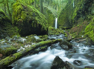
2.71.6 miThis newly discovered waterfall has become a favorite for photographers – even so, it has yet to receive an official name. The waterfall is located just 300 feet off the Ruckel Creek Trail in the Columbia River Gorge, but it can be quite challenging to access. The rewards are well worth the slipp...Read more -
Cascade Locks, Oregon
Wauna Viewpoint Trail
3.26 mi / 1086 ft gainWauna Viewpoint Trail is an out-and-back trail that takes you by a river located near Cascade Locks, Oregon.Read more -
Cascade Locks, Oregon
Tunnel Falls
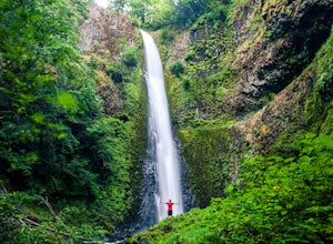
4.411.87 mi / 2874 ft gainThis hike begins at the Eagle Creek Trailhead. This is the same trailhead that goes to popular Punchbowl Falls. The trail to reach Tunnel Falls is 12 miles roundtrip on an out and back trail. If you continue another 0.5 miles on the trail after Tunnel Falls you will reach Twister Falls. The hike ...Read more -
Cascade Locks, Oregon
Gorton Creek Falls
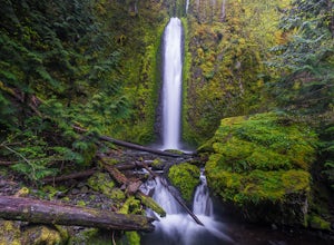
4.71.01 mi / 361 ft gainThe Gorton Creek Falls hike provides an excellent challenge for those who are searching for a bit of adventure. The trailhead starts at the Wyeth Campground day use area, and continues straight at the intersection. The first 2/3rds of the trail are relatively easy to traverse (depsite being rough...Read more -
Cascade Locks, Oregon
North Lake via Wyeth Trail
1.012.36 mi / 4505 ft gainPark at the Wyeth Trailhead parking lot and start hiking south along the old road bed. At the junction with the Gorge-Wyeth Trail, bear left and follow the Wyeth Trail as it goes beneath several power lines. Follow the trail as it goes back into the woods and crosses Harphan Creek. Continue on an...Read more -
Cascade Locks, Oregon
Wyeth to Gorge Trail
3.99 mi / 925 ft gainWyeth to Gorge Trail is an out-and-back trail that takes you by a river located near Cascade Locks, Oregon.Read more


