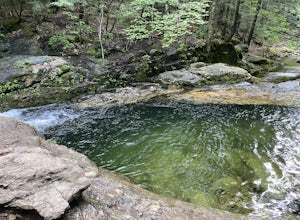
The Best Hiking in Chatham
Looking for the best hiking in Chatham? We've got you covered with the top trails, trips, hiking, backpacking, camping and more around Chatham. The detailed guides, photos, and reviews are all submitted by the Outbound community.
Top hiking spots in and near Chatham
-
Chatham, New Hampshire
Slippery Brook Trail
11.49 mi / 2874 ft gainSlippery Brook Trail is an out-and-back trail that takes you through a nice forest located near Center Conway, New Hampshire.Read more -
Chatham, New Hampshire
Mountain Pond Trail
2.62 mi / 43 ft gainMountain Pond Trail is a loop trail that takes you by a lake located near Jackson, New Hampshire.Read more -
Chatham, New Hampshire
Baldface Trail
9.26 mi / 3294 ft gainBaldface Trail is a loop trail that takes you by a river located near Intervale, New Hampshire.Read more -
Chatham, New Hampshire
Baldface and Slippery Brook Loop
9.83 mi / 3278 ft gainBaldface and Slippery Brook Loop is a loop trail that provides a good opportunity to view wildlife located near Center Conway, New Hampshire.Read more -
Chatham, New Hampshire
Baldface Circle Trail to Emerald Pool
1.57 mi / 217 ft gainBaldface Circle Trail to Emerald Pool is an out-and-back trail that takes you by a waterfall located near Center Conway, New Hampshire.Read more -
Chatham, New Hampshire
Mount Meader Trail
6.23 mi / 2211 ft gainMount Meader Trail is an out-and-back trail where you may see beautiful wildflowers located near Intervale, New Hampshire.Read more -
Chatham, New Hampshire
Meader Ridge Trail
8.85 mi / 2700 ft gainMeader Ridge Trail is an out-and-back trail where you may see beautiful wildflowers located near Center Lovell, Maine.Read more -
Stow, Maine
White Cairn Trail
3.07 mi / 1201 ft gainWhite Cairn Trail is an out-and-back trail that provides a good opportunity to view wildlife located near Lovell, Maine.Read more -
Stow, Maine
Shell Pond Loop
3.38 mi / 279 ft gainShell Pond Loop is a loop trail that takes you through a nice forest located near Bethel, Maine.Read more -
Stow, Maine
Hike to Rattlesnake Pool
2.11 mi / 207 ft gainThe best place to start your hike is from Route 113 near Gilead, head towards Stone House Road. This becomes Shell Pond Road. A few miles in, you'll find a gated area where you can park. This trail, and Rattlesnake Pool, are both on private land - so be sure to practice leave no trace principles.Read more -
Stow, Maine
Rattlesnake Pool
2.38 mi / 226 ft gainRattlesnake Pool is an out-and-back trail that takes you by a river located near Fryeburg, Maine.Read more -
Lovell, Maine
Kezar River Trail
1.48 mi / 144 ft gainKezar River Trail is a loop trail that takes you by a river located near Lovell, Maine.Read more -
Jackson, New Hampshire
South Doublehead via New Path, Old Path, Doublehead Ski Trail
2.93 mi / 1490 ft gainSouth Doublehead via New Path, Old Path, Doublehead Ski Trail is a loop trail where you may see beautiful wildflowers located near Jackson, New Hampshire.Read more -
Jackson, New Hampshire
Doublehead Ski Trail to North and South Doublehead
3.44 mi / 1588 ft gainDoublehead Ski Trail to North and South Doublehead is a loop trail where you may see beautiful wildflowers located near Jackson, New Hampshire.Read more -
Unorganized Territory of South Oxford, Maine
Bickford Brook Trail to Speckled Mountain
8.28 mi / 2379 ft gainBickford Brook Trail to Speckled Mountain is an out-and-back trail that takes you by a waterfall located near Fryeburg, Maine.Read more -
Chatham, New Hampshire
Basin and Hermit Falls Trail
2.74 mi / 262 ft gainBasin and Hermit Falls Trail is an out-and-back trail where you may see beautiful wildflowers located near Center Conway, New Hampshire.Read more


