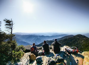
The Best Hiking in Gatlinburg
Looking for the best hiking in Gatlinburg? We've got you covered with the top trails, trips, hiking, backpacking, camping and more around Gatlinburg. The detailed guides, photos, and reviews are all submitted by the Outbound community.
Top hiking spots in and near Gatlinburg
-
Gatlinburg, Tennessee
Twin Creeks Trail
4.04.54 mi / 879 ft gainTwin Creeks Trail is an out-and-back trail that takes you by a river located near Gatlinburg, Tennessee.Read more -
Gatlinburg, Tennessee
Old Sugarlands Trail
7.65 mi / 1316 ft gainOld Sugarlands Trail is an out-and-back trail that takes you by a river located near Gatlinburg, Tennessee.Read more -
Gatlinburg, Tennessee
Old Sugarlands, Twin Creeks, Gatlinburg Loop Trail
10.38 mi / 1509 ft gainOld Sugarlands, Twin Creeks, Gatlinburg Loop Trail is a loop trail where you may see beautiful wildflowers located near Gatlinburg, Tennessee.Read more -
Gatlinburg, Tennessee
Gatlinburg Trail
3.8 mi / 351 ft gainGatlinburg Trail is an out-and-back trail that takes you by a waterfall located near Gatlinburg, Tennessee.Read more -
Gatlinburg, Tennessee
Cataract Falls, Smoky Mountains
4.51.09 miYou will find the trailhead to this gravel path just to the left of the Sugarlands Visitor Center. The easy walk along Fighting Creek is scenic and tends not to be crowded, either. At the end of the hike you will find a beautiful 25-foot waterfall. Please refrain from climbing on or around the f...Read more -
Gatlinburg, Tennessee
Noah "Bud" Ogle Self-Guiding Trail
0.76 mi / 131 ft gainNoah "Bud" Ogle Self-Guiding Trail is a loop trail where you may see beautiful wildflowers located near Gatlinburg, Tennessee.Read more -
Gatlinburg, Tennessee
Fighting Creek Nature Trail
1.38 mi / 118 ft gainFighting Creek Nature Trail is a loop trail where you may see beautiful wildflowers located near Gatlinburg, Tennessee.Read more -
Gatlinburg, Tennessee
Sugarlands Valley Nature Trail
0.94 mi / 39 ft gainSugarlands Valley Nature Trail is a loop trail that takes you by a river located near Gatlinburg, Tennessee.Read more -
Gatlinburg, Tennessee
Rainbow Falls Trail
5.34 mi / 1781 ft gainRainbow Falls Trail is an out-and-back trail that takes you by a waterfall located near Gatlinburg, Tennessee.Read more -
35.675929,-83.485764
Roaring Fork Motor Nature Trail
5.05.83 miThis 6 mile drive is a great way to spend a scenic day in the Smokies. The road is open to cars only (no trucks or RVs) and runs one-way. There are no visitors centers after you head out, so be sure to bring everything you need along. The drive begins at the historic Ogle farmstead, which is als...Read more -
Gatlinburg, Tennessee
Trillium Gap, Grotto Falls, Brushy Mountain, Bull Head Trail Loop
16.3 mi / 4695 ft gainTrillium Gap, Grotto Falls, Brushy Mountain, Bull Head Trail Loop is a loop trail that takes you by a waterfall located near Gatlinburg, Tennessee.Read more -
Gatlinburg, Tennessee
Mount LeConte via Rainbow Falls Trail
13.56 mi / 4134 ft gainMount LeConte via Rainbow Falls Trail is an out-and-back trail that takes you by a waterfall located near Gatlinburg, Tennessee.Read more -
Gatlinburg, Tennessee
Mount LeConte and Rainbow Falls via The Bullhead Trail
13.24 mi / 4364 ft gainMount LeConte and Rainbow Falls via The Bullhead Trail is a loop trail where you may see beautiful wildflowers located near Gatlinburg, Tennessee.Read more -
Gatlinburg, Tennessee
Rainbow Falls Trail and Cliff Tops Trail
13.19 mi / 4255 ft gainRainbow Falls Trail and Cliff Tops Trail is an out-and-back trail that takes you by a waterfall located near Gatlinburg, Tennessee.Read more -
Gatlinburg, Tennessee
Mount LeConte-Cliff Tops via Rainbow Falls Trail
4.513.37 mi / 3993 ft gainBegin at the Rainbow Falls trail parking lot. This is very popular area especially in the summer. If the parking area at the trail head is full there is additional parking located just past the main lot. From here the Rainbow Falls trail is just under 14 miles to the summit of Mount Leconte. Elev...Read more -
Gatlinburg, Tennessee
Trillium Gap Trail to Grotto Falls
7.09 mi / 1654 ft gainTrillium Gap Trail to Grotto Falls is an out-and-back trail that takes you by a waterfall located near Gatlinburg, Tennessee.Read more

