The Best Hiking in Tellico Plains
Looking for the best hiking in Tellico Plains? We've got you covered with the top trails, trips, hiking, backpacking, camping and more around Tellico Plains. The detailed guides, photos, and reviews are all submitted by the Outbound community.
Top hiking spots in and near Tellico Plains
-
Tellico Plains, Tennessee
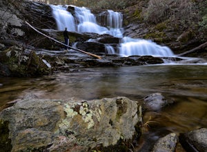
Conasauga Falls Trail
1.25 mi / 335 ft gainConasauga Falls Trail is an out-and-back trail that takes you by a waterfall located near Tellico Plains, Tennessee.Read more -
Tellico Plains, Tennessee
Hike to Conasauga Falls
4.51.5 mi / 400 ft gainGetting to the trailhead can be a challenge if there has been any heavy precipitation or icy conditions due to the fact the last two miles are one mile of broken pavement and the last mile a dirt road. You should be fine in good conditions in any car; however, just make sure to take it easy on th...Read more -
Tellico Plains, Tennessee
Bald River Trail
9.34 mi / 1371 ft gainBald River Trail is an out-and-back trail that takes you by a waterfall located near Tellico Plains, Tennessee.Read more -
Etowah, Tennessee
Cooper Gap Trail (#119)
6.31 mi / 1594 ft gainCooper Gap Trail (#119) is a loop trail where you may see beautiful wildflowers located near Englewood, Tennessee.Read more -
Tellico Plains, Tennessee
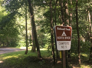
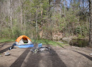
Camp at North River Campground and Dispersed Campsites
North River Road is located in the Nantahala National Forest near Tellico Plains. To get to North River Campground you can either drive up the Cherohala Skyway about 6 miles then turn when you see the sign for the campground and bald river falls. Another way to get to the campsites along North Ri...Read more -
Tellico Plains, Tennessee
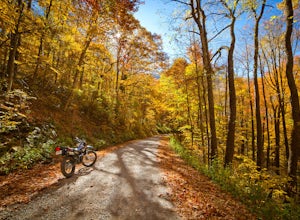
Explore North River Road
4.7If you're looking to get off the beaten path and take the road less traveled, North River Road is your ticket to solitude.A popular loop for the locals is starting on Tellico River Road, then getting on North River Road to make your way up the mountain all the way to the Cherohala Skyway. Take th...Read more -
Tellico Plains, Tennessee
Indian Boundary Lake Trail
2.96 mi / 161 ft gainIndian Boundary Lake Trail is a loop trail that takes you by a lake located near Tellico Plains, Tennessee.Read more -
Vonore, Tennessee
Camp at Citico Creek
5.0There are a few options for getting to Citico Creek, you can either go up the windy gravel road from US 411 or get off of the Cherohala Skyway and go down the mountain past the Indian Boundary campground. The Citico Creek campground has about 5 or 6 spots but is rarely full because it is very sec...Read more -
Tellico Plains, Tennessee
Falls Branch Trail
2.04 mi / 495 ft gainFalls Branch Trail is an out-and-back trail that takes you by a waterfall located near Tellico Plains, Tennessee.Read more -
Tellico Plains, Tennessee
Hike to Falls Branch Falls
5.02.6 mi / 540 ft gainTo get to the trailhead, drive 22.5 miles on the Cherohala Skyway from Tellico Plains, Tennessee. If you are coming from the North Carolina side, drive 20.5 miles to the trailhead. The trailhead parking area is marked by a large green sign saying West Rattlesnake and is surrounded by a low stone ...Read more -
Tellico Plains, Tennessee
South Fork Citico Trail
8.27 mi / 2037 ft gainSouth Fork Citico Trail is an out-and-back trail where you may see beautiful wildflowers located near Tellico Plains, Tennessee.Read more -
Farner, Tennessee
Turtletown Falls Trail
3.45 mi / 377 ft gainTurtletown Falls Trail is a loop trail that takes you by a waterfall located near Farner, Tennessee.Read more -
Robbinsville, North Carolina
Beech Gap to Bob Bald Trail
6.62 mi / 1253 ft gainBeech Gap to Bob Bald Trail is an out-and-back trail where you may see beautiful wildflowers located near Tallassee, Tennessee.Read more -
Tellico Plains, North Carolina
Hike to Whiggs Meadow
3 mi / 700 ft gainYou will start your hike off of the Cherohala Skyway. The trail-head is a small asphalt pull-off on the right if you are coming from Tellico Plains. From the trail-head the trail starts up and almost all of the trial is an uphill incline on the way there with about 700 feet of elevation change ov...Read more -
Tellico Plains, Tennessee
Whigg Meadow via Mud Gap Trail
3.36 mi / 656 ft gainWhigg Meadow via Mud Gap Trail is an out-and-back trail where you may see beautiful wildflowers located near Robbinsville, North Carolina.Read more -
Delano, Tennessee
Gee Creek Trail
2.69 mi / 614 ft gainGee Creek Trail is an out-and-back trail that takes you by a waterfall located near Delano, Tennessee.Read more


