The Best Hiking in Ontonagon
Looking for the best hiking in Ontonagon? We've got you covered with the top trails, trips, hiking, backpacking, camping and more around Ontonagon. The detailed guides, photos, and reviews are all submitted by the Outbound community.
Top hiking spots in and near Ontonagon
-
Ontonagon, Michigan
Backpack the Union Spring and Lost Lake Trails in the Porkies
8.1 mi / 600 ft gainThe hike begins at the Union Spring trailhead, roughly two miles south of the Park Headquarters on Boundary Road. This area of the park is also the winter cross country and snowshoeing section of the park, so many of the trails are marked for winter travel. To make sure you stay on the summer rou...Read more -
Ontonagon, Michigan
Union Mine Trail
1.07 mi / 141 ft gainUnion Mine Trail is a loop trail that takes you by a river located near Ontonagon, Michigan.Read more -
Bruce Crossing, Michigan
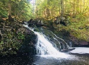
Hike to O Kun de Kun Falls
2.6 mi / -100 ft gainLocated roughly 8 miles north of Bruce Crossing on Highway 45, the O Kun de Kun Trailhead is a small turnoff located on the right side of the highway. The trailhead offers limited parking, but the trail is rarely busy. At the beginning the trail, hikers can see the blue blazes of the North Countr...Read more -
Marenisco, Michigan
Trap Hills Traverse
5.9 mi / 1050 ft gainTrap Hills Traverse is a loop trail that takes you by a river located near Bergland, Michigan.Read more -
Ontonagon, Michigan
Government Peak Trail to Union Spring
8.3 mi / 968 ft gainGovernment Peak Trail to Union Spring is a loop trail that is moderately difficult located near Ontonagon, Michigan.Read more -
Ontonagon, Michigan
Trap Falls Trail
4 mi / 502 ft gainTrap Falls Trail is an out-and-back trail that takes you by a river located near Ontonagon, Michigan.Read more -
Matchwood Township, Michigan
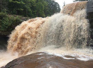
Cascade Falls Trail
1.66 mi / 377 ft gainCascade Falls Trail is a loop trail that takes you by a waterfall located near Bergland, Michigan.Read more -
Ontonagon, Michigan
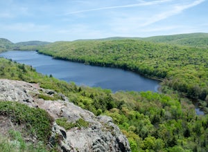
Hike Lake of the Clouds in the Porcupine Mountains
1.4 mi / 334 ft gainHiking in the porcupine mountains could be a day trip or a week trip. From a short rim hike overlooking Lake of the Clouds to a three day back country camping excursion, there are endless amounts of options for planning a getaway to the Porcupine Mountains. Located in the far northwest of Michig...Read more -
Ontonagon, Michigan
Government Peak Loop
13.28 mi / 1749 ft gainGovernment Peak Loop is a loop trail that takes you by a lake located near Ontonagon, Michigan.Read more -
Ontonagon, Michigan
Hike the Escarpment Trail
3.58.6 miUpon arriving at Porcupine Mountains State Park (from Highway 107) in Ontonagon, Michigan, follow signs to the Lake of the Clouds Overlook parking lot. From this overlook you will get a taste of the many views of Lake of the Clouds that are to come. The Escarpment Trail begins here and parallels ...Read more -
Ontonagon, Michigan
Backpack the Big Carp River and Lake Superior Trails in the Porkies
18.2 miWe started our hiking in the afternoon at the Lake of the Clouds parking lot. Our original plan for the hike was to thru hike the Lake Superior Trail, however, due to muddy conditions and recent rain, we chose the Big Carp River Trail as a dryer route to get to our mid-camp point near the Big Car...Read more -
Ontonagon, Michigan
Lake of the Clouds
1.23 mi / 364 ft gainLake of the Clouds is an out-and-back trail where you may see beautiful wildflowers located near Ontonagon, Michigan.Read more -
Ontonagon, Michigan
Superior, Big Carp, and Escarpment Loop
17.84 mi / 1624 ft gainSuperior, Big Carp, and Escarpment Loop is a loop trail that takes you by a lake located near Ontonagon, Michigan.Read more -
Ontonagon, Michigan
Mirror Lake Trail
4.91 mi / 614 ft gainMirror Lake Trail is an out-and-back trail that takes you by a lake located near Ontonagon, Michigan.Read more -
Ontonagon, Michigan
Beaver Creek to Little Carp River to South Mirror Lake to Summit Peak Loop
4.85 mi / 558 ft gainBeaver Creek to Little Carp River to South Mirror Lake to Summit Peak Loop is a loop trail that takes you by a lake located near Ontonagon, Michigan.Read more -
Ontonagon, Michigan
Mirror Lake Cabins Loop
6.24 mi / 584 ft gainThe trip to Mirror Lake begins at the Summit Peak Scenic Area. To extend your hike, start at the Lily Pond trail-head farther south on Summit Peak Road (5.3 miles to cabin). The initial trail towards the lake is the Beaver Creek trail (1.2 miles). The trail climbs down the peak slope into some lo...Read more

