The Best Hiking in Granby
Looking for the best hiking in Granby? We've got you covered with the top trails, trips, hiking, backpacking, camping and more around Granby. The detailed guides, photos, and reviews are all submitted by the Outbound community.
Top hiking spots in and near Granby
-
Granby, Connecticut
Hike Mclean Blue To Red Trail
3.1 mi / 265 ft gainMclean Blue To Red Trail is a 3.1 mile loop hike that takes you past great forest setting located near Granby, Connecticut.Read more -
Granby, Connecticut
Hike Mc Lean Game Refuge Trail
3.4 mi / 265 ft gainMcLean Game Refuge Peak Trail is a 3.4 mile loop hike that takes you past great forest setting located near Granby, Connecticut.Read more -
Granby, Connecticut
Hike Stony Hill, East Barbadoor Hill, And Spring Pond Loop
5.9 mi / 682 ft gainStony Hill, East Barbadoor Hill, and Spring Pond Loop is a 5.9 mile loop hike that takes you past scenic views located near Granby, Connecticut.Read more -
Granby, Connecticut
Hike Mc Lean Blue And Yellow Blaze Trail Loop
3.3 mi / 190 ft gainMcLean Blue and Yellow Blaze Trail Loop is a 3.3 mile loop hike that takes you by a lake located near Granby, Connecticut.Read more -
Granby, Connecticut
Hike Mc Leans Purple Blazes
3.1 mi / 452 ft gainMcLeans Purple Blazes is a 3.1 mile loop hike that takes you past great forest setting located near Granby, Connecticut.Read more -
Granby, Connecticut
Hike Spring Pond Loop
1.3 mi / 127 ft gainSpring Pond Loop is a 1.3 mile loop hike that takes you past scenic views located near Granby, Connecticut.Read more -
Granby, Connecticut
Hike Holcomb Farm Western Trails (Outer Loop)
3.4 mi / 429 ft gainHolcomb Farm Western Trails (Outer Loop) is a 3.4 mile loop hike that takes you by a river located near West Granby Historic, Connecticut.Read more -
East Granby, Connecticut
Hike Peak Mountain Via Metacomet Trail
3.6 mi / 524 ft gainPeak Mountain via Metacomet Trail is a 3.6 mile out and back hike where you may see beautiful wild flowers located near East Granby, Connecticut.Read more -
Suffield, Connecticut
Hike Farmington Canal Heritage Trail And Southwick Rail Trail: Phelps Road To Shaker Road
6.8 mi / 121 ft gainFarmington Canal Heritage Trail and Southwick Rail Trail: Phelps Road to Shaker Road is a 6.8 mile point-to-point hike that takes you by a lake located near West Suffield, Connecticut.Read more -
East Granby, Connecticut
Hike Metacomet Trail Blue Blaze Loop
3.4 mi / 413 ft gainMetacomet Trail Blue Blaze Loop is a 3.4 mile loop hike where you may see beautiful wild flowers located near East Granby, Connecticut.Read more -
East Granby, Connecticut
Hike Cowles Park Yellow Loop
1.2 mi / 72 ft gainCowles Park Yellow Loop is a 1.2 mile loop hike where you may see beautiful wild flowers located near East Granby, Connecticut.Read more -
East Granby, Connecticut
Hike Cowles Park Purple Trail
2.3 mi / 98 ft gainCowles Park Purple Trail is a 2.3 mile loop hike that takes you past great forest setting located near East Granby, Connecticut.Read more -
East Granby, Connecticut
Hike Cowles Park Blue And White Trails
10.1 mi / 912 ft gainCowles Park Blue and White Trails is a 10.1 mile loop hike that takes you by a river located near East Granby, Connecticut.Read more -
Granby, Connecticut
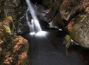
Hiking Enders Falls
4.3Enders State Forest sprawls over approximately 2000 acres, and is found within the towns of Granby and Barkhamsted in Connecticut. Enders has a good sized parking lot directly on Route 219. From the junction of Route 219 and Route 20, visitors will proceed west on Route 219 for 1.2 miles and tu...Read more -
Simsbury, Connecticut
Hike Great Pond Loop
1.4 mi / 13 ft gainGreat Pond Loop is a 1.4 mile loop hike that takes you by a lake located near Simsbury, Connecticut.Read more -
Simsbury, Connecticut
Hike Beldon Forest
1.5 mi / 127 ft gainBeldon Forest is a 1.2 mile loop hike that takes you past great forest setting located near Simsbury, Connecticut.Read more


