The Best Hiking in Alta
Looking for the best hiking in Alta? We've got you covered with the top trails, trips, hiking, backpacking, camping and more around Alta. The detailed guides, photos, and reviews are all submitted by the Outbound community.
Top hiking spots in and near Alta
-
Moose, Wyoming
Jolly Green Giant
3.26 mi / 574 ft gainJolly Green Giant is an out-and-back trail where you may see beautiful wildflowers located near Alta, Wyoming.Read more -
Moose, Wyoming
Fred's Mountain via Bannock Trail
5.84 mi / 1841 ft gainFred's Mountain via Bannock Trail is an out-and-back trail where you may see beautiful wildflowers located near Alta, Wyoming.Read more -
Alta, Wyoming
Rick's Basin
2.97 mi / 289 ft gainRick's Basin is a loop trail where you may see beautiful wildflowers located near Alta, Wyoming.Read more -
Alta, Wyoming
Quakie Ridge Loop
7.22 mi / 663 ft gainQuakie Ridge Loop is a loop trail where you may see beautiful wildflowers located near Alta, Wyoming.Read more -
Moose, Wyoming
Explore Teton Creek along Sheep Bridge Trail
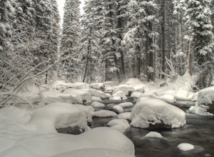
4.02 mi / 250 ft gainTrailhead: The trail is just outside of Driggs, Idaho in Alta, Wyoming on the way up to Grand Targhee Ski Resort. The hike is fairly easy, so you can enjoy the scenic views of the forest and creek, especially during the winter when the trees have a thick layer of snow on them. You also cross Teto...Read more -
Alta, Wyoming
Sheep Bridge MTB Trail
4.55 mi / 285 ft gainSheep Bridge MTB Trail is an out-and-back trail that takes you by a river located near Alta, Wyoming.Read more -
Alta, Wyoming
Teton Canyon to Jenny Lake
21.25 mi / 4331 ft gainTeton Canyon to Jenny Lake Trail is a point-to-point trail that takes you by a waterfall located near Alta, Wyoming.Read more -
Alta, Wyoming
Teton Canyon to Phelps Lake via Alaska Basin Trail
19.68 mi / 4216 ft gainTeton Canyon to Phelps Lake via Alaska Basin Trail is a point-to-point trail that takes you by a lake located near Alta, Wyoming.Read more -
Alta, Wyoming
Teton Canyon to Phelps Lake via Alaska Basin, Teton Crest, and Death Canyon Trails
22.81 mi / 3524 ft gainTeton Canyon to Phelps Lake via Alaska Basin, Teton Crest, and Death Canyon Trails is a point-to-point trail where you may see beautiful wildflowers located near Alta, Wyoming.Read more -
Alta, Wyoming
Summit Table Mountain
4.811 mi / 4000 ft gainTo climb Table Mountain you begin at the Teton Canyon Trailhead near Driggs, Idaho. The trailhead sits at about 6,800 feet elevation and from there you have two options to reach the 11,106 ft. peak -neither of which are technical, and both of which are dog-friendly.The first option, named Huckleb...Read more -
Alta, Wyoming
South Leigh Creek, Granite Basin, Green Lakes Loop
20.58 mi / 4144 ft gainSouth Leigh Creek, Granite Basin, Green Lakes Loop is a loop trail that takes you by a lake located near Alta, Wyoming.Read more -
Alta, Wyoming
Green Mountain to Green Lake
9.84 mi / 2411 ft gainGreen Mountain to Green Lake is an out-and-back trail where you may see beautiful wildflowers located near Alta, Wyoming.Read more -
Alta, Wyoming
Hike Darby Canyon to the Wind Cave
4.9The best time to hike Darby Canyon is May through September, since the snow stays late in spring and comes earlier in fall.Hiking up Darby Canyon to the Wind Caves provides spectacular views of the Jedediah Smith Wilderness and is a fun, yet challenging hike. It is a popular day hike, and many fa...Read more -
Alta, Wyoming
South Fork Cascade Canyon to Hurricane Pass
18.12 mi / 3793 ft gainSouth Fork Cascade Canyon to Hurricane Pass Trail is an out-and-back trail that takes you by a lake located near Moran, Wyoming.Read more -
Alta, Wyoming
Lake Solitude via Lake Solitude and Cascade Canyon Trail
13.83 mi / 2323 ft gainLake Solitude via Lake Solitude and Cascade Canyon Trail is an out-and-back trail that takes you by a river located near Moose, Wyoming.Read more -
Alta, Wyoming
Hidden Falls Trail
5.01.08 mi / 197 ft gainHidden Falls Trail is an out-and-back trail that takes you by a waterfall located near Moose, Wyoming.Read more


