The Best Hiking in Utah County
Looking for the best hiking in Utah County? We've got you covered with the top trails, trips, hiking, backpacking, camping and more around Utah County. The detailed guides, photos, and reviews are all submitted by the Outbound community.
Top hiking spots in and near Utah County
-
Provo, Utah
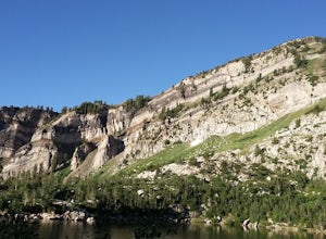
Backpack to Silver Lake
4.44.1 mi / 1500 ft gainThe trail is 4.1 miles roundtrip gaining almost 1,500 feet for the duration of the adventure. Some parts are exposed, so you can get a fair amount of sun.When you're on the trail, you'll get amazing views as you’re hiking to the lake of Mount Timpanogos and American Fork Canyon. This is followed ...Read more -
Provo, Utah
Camp at Silver Lake
4.54.4 mi / 1500 ft gainSilver Lake is a wonderful place to go if you're in need of a quick adventure in the woods. Located in the the Uinta National Forest, Silver Lake is relatively easy to get to via American Fork Canyon in Utah, however I do recommend driving a car with 4WD and can handle steep dirt roads with shar...Read more -
Provo, Utah
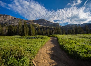
Deer Creek-Dry Creek Trail
6.97 mi / 2864 ft gainDeer Creek-Dry Creek Trail is an out-and-back trail that takes you by a river located near Aspen Grove, Utah.Read more -
Provo, Utah
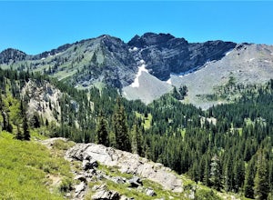
Hike the Pine Hollow Trail
4.04.4 mi / 1100 ft gainThe trailhead (Forest Trail 047 - Pine Hollow Trail) starts across the street from a turnout about .5 miles above Mutual Dell in American Fork Canyon. This highly trafficked trail is used for just about every activity you can think of, meaning that you can even snowshoe this in the winter. It's a...Read more -
Alta, Utah
Devil's Castle and Sugarloaf via Cecret Lake
4.15 mi / 1785 ft gainDevil's Castle and Sugarloaf via Cecret Lake is an out-and-back trail that takes you by a river located near Sandy, Utah.Read more -
Alta, Utah
Devils Castle
3.73 mi / 1509 ft gainDevils Castle is a loop trail where you may see beautiful wildflowers located near Sandy, Utah.Read more -
Alta, Utah
Germania Pass via East Greeley
5.39 mi / 1427 ft gainGermania Pass via East Greeley is an out-and-back trail where you may see beautiful wildflowers located near Sandy, Utah.Read more -
Alta, Utah
Cecret Lake
4.41.78 mi / 509 ft gainCecret Lake is reached by driving up Little Cottonwood Canyon to Albion Basin above Alta Ski Resort. The hike is just under 1 mile to the lake and should take about 30 minutes. The hike goes through fields full of wildflowers and wildlife is abundant. Moose, deer, and various wildlife can be s...Read more -
Alta, Utah
Devils Castle Loop
3.43 mi / 1476 ft gainDevils Castle Loop is a loop trail where you may see local wildlife located near Sandy, Utah.Read more -
Salt Lake City, Utah
Hike Catherine Pass
4 mi / 1115 ft gainCatherine Pass is a must do if you are in the Salt Lake vicinity in July. The wildflowers are mind-blowing. But it’s a great hike to do in the Spring, after Alta Ski Resort has closed, and the Fall as well. It costs $6 per vehicle to drive to the trailhead, or $10 per person to ride the lift (if...Read more -
Salt Lake City, Utah
Backpack Lake Catherine and Bag Sunset Peak
3.53 mi / 1200 ft gainAny chance to get into the backcountry of the Wasatch Mountains is worth it. Many people day hike in the area, but not very many backpack in. The trail meets up with the Great Western Trail and overlooks Lake Catherine. The best place to camp is in the woods next to the lake. Hike down to the lak...Read more -
Salt Lake City, Utah
Hike Mount Wolverine
4 mi / 1425 ft gainThis mountain can be conquered two ways and is a great after-work adventure to watch the sunset, an early morning trail run, or a fun family challenge. The trail is 4 miles and 1,425 feet elevation gain (from the Alta side) or 6 miles and 2,050 feet (from the Brighton side). Both routes converge ...Read more -
Sandy, Utah
Snowbird Ridge Twin Peaks Trail
8.92 mi / 3602 ft gainSnowbird Ridge Twin Peaks Trail is an out-and-back trail that takes you by a lake located near Mounthaven, Utah.Read more -
Sandy, Utah
Photograph Little Cottonwood Creek at Snowbird
2.0Little Cottonwood Creek flows right through Snowbird Ski Resort and there are a few beautiful locations to go shoot the river at. The best place to start hiking down the river is right by where the tram takes off. That is just below the Cliff Lodge and right by the Peruvian Lift. There's a res...Read more -
Sandy, Utah
Snowbird Observation Point Trail
1.04 mi / 118 ft gainSnowbird Observation Point Trail is an out-and-back trail where you may see wildflowers located near Mounthaven, Utah.Read more -
Sandy, Utah
Backcountry Ski Suicide Chute on Mt. Superior
5.00.6 mi / 1245 ft gainFirst of all it's not as scary as it sounds, or as scary as it looks. That being said it's a steep chute in dangerous avalanche terrain so only experienced skiers with backcountry skiing knowledge/equipment should attempt this route.Suicide Chute is located on the South face of Mt. Superior in L...Read more


