The Best Hiking in Ronald
Looking for the best hiking in Ronald? We've got you covered with the top trails, trips, hiking, backpacking, camping and more around Ronald. The detailed guides, photos, and reviews are all submitted by the Outbound community.
Top hiking spots in and near Ronald
-
Cle Elum, Washington
Wenatchee Yellow Hill Trail #1222
26.79 mi / 6955 ft gainWenatchee Yellow Hill Trail #1222 is an out-and-back trail where you may see beautiful wildflowers located near Cle Elum, Washington.Read more -
Ronald, Washington
Hex Mountain Trail
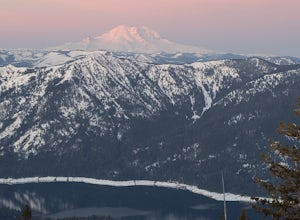
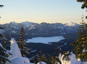
7.36 mi / 2710 ft gainHex Mountain is a steep but rewarding out and back hike/snowshoe with 360 views from the peak. On a clear day you can see Mount Rainier, the Teanaways, the Stuart range, and many other surrounding peaks. Low avalanche risk makes this an enjoyable winter destination for snowshoers and backcountry ...Read more -
Ronald, Washington
Camping at French Cabin Creek Rd.
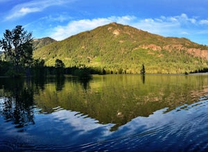
3.0This area is a very secluded camp area, so unless it's a holiday weekend, be prepared to be alone :) It is a very quiet lake and along the roadside there are plenty of spots to hike, camp, and fish by the lake or the Cle Elum river.So bring your day hiking gear and pole as well and head out in th...Read more -
Cle Elum, Washington
West Fork Teanaway Trail
11.17 mi / 1073 ft gainWest Fork Teanaway Trail is a point-to-point that takes you through a nice forest located near Cle Elum, Washington.Read more -
Snoqualmie Pass, Washington
Thorp Mountain Trail
6.68 mi / 2274 ft gainThorp Mountain Trail is an out-and-back trail that takes you through a nice forest located near Roslyn, Washington.Read more -
Snoqualmie Pass, Washington
Thorp Mountain via Knox Creek and Kachess Ridge Trails
4.33 mi / 1677 ft gainThorp Mountain via Knox Creek and Kachess Ridge Trails is an out-and-back trail where you may see beautiful wildflowers located near Snoqualmie Pass, Washington.Read more -
Snoqualmie Pass, Washington
Thorp Lake and Thorp Mountain
7 mi / 2326 ft gainThorp Lake and Thorp Mountain is an out-and-back trail that takes you by a lake located near Snoqualmie Pass, Washington.Read more -
Snoqualmie Pass, Washington
Thorp Lake via Thorp Creek Trail
4.89 mi / 1319 ft gainThorp Lake via Thorp Creek Trail is an out-and-back trail that takes you by a lake located near Snoqualmie Pass, Washington.Read more -
Ronald, Washington
Spade Lake and Venus Lake via Waptus River Trail
26.55 mi / 5771 ft gainSpade Lake and Venus Lake via Waptus River Trail is an out-and-back trail that takes you by a lake located near Easton, Washington.Read more -
Ronald, Washington
Spade and Venus Lakes
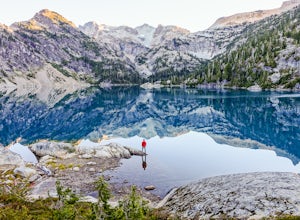
5.026.47 mi / 2300 ft gainNestled in a high rocky cirque near the upper reaches of Mt Daniel, Spade and Venus Lakes are two of the most remote lakes in the Alpine Lake Wilderness. But to experience this level of pure isolation, you'll need to earn it; the shortest hike in to the lakes is 14 miles, the majority of which i...Read more -
Snoqualmie Pass, Washington
Hike to Thorp Mountain Lookout
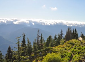
2.5 mi / 1650 ft gainThis trail features beautiful wildflower meadows during the summer season and is relativity low trafficked. Bring your hammock for breathtaking views from the lookout and catch an incredible sunset. The summit has no established camping spots, so if staying overnight prepare to sleep on uneven gr...Read more -
Easton, Washington
Snowshoe to Amabilis Mountain
9.5 mi / 2100 ft gainTo reach Amabilis Mountain, park at the Cabin Creek Sno Park at Exit 63 off I-90. Take the overpass across the highway to the trailhead and strap on your snowshoes. There's a maze of cross-country ski trails, but you'll want to keep to the right and follow the Berg trail for a quarter mile until ...Read more -
Cle Elum, Washington
Backpack to Navaho Pass
12 mi / 4220 ft gainThis is a beautiful trail in the Teanaway area, located in Washington State. The trailhead starts along the Stafford Creek Trail and follows the creek for the first couple miles of the trail. There are a number of different types of wildflowers out here that make the first few miles a nice warmup...Read more -
Leavenworth, Washington
Day Hike to Lake Ingalls
4.39 mi / 2500 ft gainFrom the parking lot you start out on an old miners road that leads to the trail. Keep right at the first fork (left lead to Esmeralda Basin), then in about 2 miles, go left at the next fork (right leads to Ingalls Pass). The trail will climb steadily as you continue. In about another mile you wi...Read more -
Leavenworth, Washington
Mountain Run to Lake Ann and Ingalls
9 mi / 2500 ft gainBoth trails start at the Esmeralda Trailhead, Trail Number 1394. Lake Ann has a handful of folks that you will run into, whereas Lake Ingalls is a well-traveled trail. Both offer camping spots along the trail, and Lake Ann has spots where you can camp by the lake. NO CAMPING ALLOWED at Lake Ingal...Read more -
Leavenworth, Washington
Climb Mount Stuart
5.0Global climbing legend Fred Beckey once said, "[Mount Stuart is] without a rival as the crown peak in the central Cascades of Washington, Mount Stuart has been pronounced the single greatest mass of exposed granite in the United States".To ascend the mountain by is easiest route, the Cascading Co...Read more


