Calabasas
Top Spots
Hike Calabasas Peak Motorway
Topanga, California
7.3 mi
/ 1817 ft gain
Getting There
You can, from Los Angeles, go one of three ways: take I-405 to US-101 and head west, or from downtown, take US-101 the whole way, OR, get on I-10 from the Westside or east of there and take that until it becomes PCH, then take that to Topanga Canyon (turn left onto Old Topanga Canyon after a bit) or, for the more adventurous types, take Las Flores Canyon to Rambla Pacifica, Scheue...
Calabasas Cold Creek Trail
Calabasas, California
3.87 mi
/ 804 ft gain
Calabasas Cold Creek Trail is an out-and-back trail where you may see wildflowers located near Calabasas, California.
Hike the Top of Topanga Overlook
Topanga, California
1 mi
/ 1613 ft gain
The Top of Topanga Overlook is where you can simply park your car, and sit in one of the benches to view the San Fernando Valley. But there is one hiking trail in that area which lets you get better vantage points, as well as a quick workout.Once you get to the overlook, park your car and safely cross the street. There are no stoplights, so be aware of the cars passing by.Directly across you wi...
East Las Virgenes Canyon Trail Loop
34.1853982875916,-118.668453097343, California
0.87 mi
/ 190 ft gain
East Las Virgenes Canyon Trail Loop is a loop trail that provides a good opportunity to view wildlife located near West Hills, California.
Laskey Mesa Trail
34.1854293506055,-118.668501377106, California
5.44 mi
/ 574 ft gain
Laskey Mesa Trail is a loop trail where you may see wildflowers located near Woodland Hills, California.
Victory Trailhead to Simi Valley via Simi Hills
34.1854870390296,-118.66846382618, California
11.86 mi
/ 1617 ft gain
Victory Trailhead to Simi Valley via Simi Hills is a point-to-point trail where you may see wildflowers located near West Hills, California.
Mary Wiesbrock Loop Trail
34.1856468,-118.66898, California
3.69 mi
/ 305 ft gain
Mary Wiesbrock Loop Trail is a loop trail that provides a good opportunity to see wildlife located near West Hills, California.
Hike the Upper Las Virgenes Canyon Open Space Preserve Trail
Ventura County, California
8.6 mi
/ 1851 ft gain
The most popular point of entry is through the Victory Trailhead, which has ample parking. You can park on the street or you can pay $3 to park at the trailhead parking lot. You can also enter at the Upper Las Virgenes Canyon Trailhead at the northern end of Las Virgenes Canyon Road in Calabasas. Once you are in, it is easy to forget about city life outside. There are a plethora of connecting t...
El Escorpion Trail to Hunter Allen Trail
Los Angeles County, California
2.62 mi
/ 377 ft gain
El Escorpion Trail to Hunter Allen Trail is an out-and-back trail where you may see beautiful wildflowers located near West Hills, California.
Places to stay
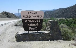
Castaic, California
Pyramid Lake Emigrant Landing Day Use Area
Overview
This facility does not accept reservations.
Emigrant Landing is the largest day use recreation area on beautiful Pyramid Lake. ...
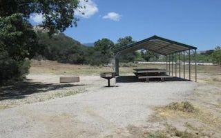
Castaic, California
Pyramid Lake Los Alamos Campground
Overview
Los Alamos Campground is located 90 minutes from Los Angeles, offering a restful experience without the lengthy travel time. Gue...
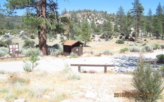
Palmdale, California
Meadow Group Campground
Overview
Meadow Group Campground is located off State Highway 2 between the Manzanita Loop of the Chilao Campground and the Chilao Ranger...
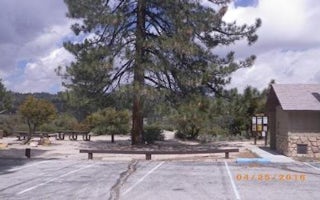
Palmdale, California
Coulter Group Campground
Overview
At Coulter Group Campground groups can relax and enjoy the experience of being outdoors without traveling far from the greater L...
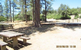
Pearblossom, California
Bandido Group Campground
Overview
Groups of all types will enjoy staying at the Bandido Group Campground, which boasts beautiful scenery in a relaxing, rustic atm...
Guides and stories
Quick links
- The best hiking trails in Calabasas
- The best backpacking in Calabasas
- The best camping in Calabasas
- Top adventures in Calabasas
Community
© 2023 The Outbound Collective - Terms of Use - Privacy Policy


