Paicines
Top Spots
Camp in Pinnacles National Park
Paicines, California
4.0
/ 1819 ft gain
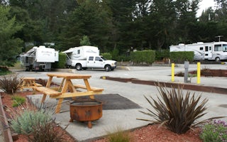
Pinnacles Campground is accessible from the east side of the park, and you generally lose cell service about 20 minutes before the park entrance. The campground offers tent camping, group camping, and a handful of RV sites. The tent and group sites have individual picnic tables and fire rings, and the RV sites typically have electrical hookups and community tables and barbecue pits. Campsite 18...
Hike the Old Pinnacle Trail in Pinnacles National Park
Paicines, California
5.0
9 mi
/ 2000 ft gain
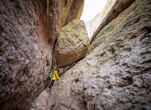
Start at the Old Pinnacles Trailhead and embark on a roughly 9 mile long adventure surrounded by amazing geological rock formations and natural landscapes. Bask in the peace of nature... meander through meadows alongside the West Fork of Chalone Creek and into Old Pinnacles. Continuing on at the next junction-hang left and trek on to the Balconies Cave Trail. Adventure through the Balconies Cav...
Hike the High Peaks & Balconies Cave Loop
Paicines, California
5.0
8.4 mi
/ 1540 ft gain
This hike can begin at Old Pinnacles Trailhead (East Entrance) or Chaparral Trailhead (West Entrance) and can be hiked in either direction. This description is from Old Pinnacles Trailhead, hiking clockwise, which gets the most demanding part of the hike done first.
From Old Pinnacles Trailhead walk 0.2 miles to get on the High Peaks Trail, which quickly starts switchbacking up to the High Peak...
Old Pinnacles Trail to Balconies
Paicines, California
5.36 mi
/ 650 ft gain
Old Pinnacles Trail to Balconies is a loop trail where you may see beautiful wildflowers located near Paicines, California.
Old Pinnacles, Balconies Cliffs, Juniper Canyon, High Peaks and Bench Trail Loop
Paicines, California
8.34 mi
/ 1978 ft gain
Old Pinnacles, Balconies Cliffs, Juniper Canyon, High Peaks and Bench Trail Loop is a loop trail that takes you by a river located near Soledad, California.
Condor Gulch Overlook Loop via Peaks View Area
Paicines, California
5.74 mi
/ 1490 ft gain
Condor Gulch Overlook Loop via Peaks View Area is a loop trail where you may see wildflowers located near Paicines, California.
High Peaks Trail
Paicines, California
6.67 mi
/ 1683 ft gain
High Peaks Trail is a loop trail where you may see beautiful wildflowers located near Paicines, California.
Peaks View Day Use Area to Old Pinnacles Trailhead
Paicines, California
3.23 mi
/ 364 ft gain
Peaks View Day Use Area to Old Pinnacles Trailhead is an out-and-back trail where you may see local wildlife located near Paicines, California.
Explore Pinnacles National Park
San Benito County, California
4.6
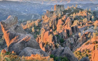
It’s hard to believe how many people don’t know about this place, which was newly designated as a National Park in January 2013. Pinnacles National Park is hidden just south of San Jose in the Gabilan Mountains, and is a short drive for anyone living in the Bay Area.With beautiful rock spires piercing the horizon, huge boulders, inviting caves, light crowds, and endangered California condors fl...
Places to stay
Paicines, California
Pinnacles Campground
Overview
Pinnacles Campground is located in the unique Pinnacles National Park, 32 miles south of Hollister, California. The park encompa...
From $30 / night
Greenfield, California
Arroyo Seco
Overview
Arroyo Seco Campground is a semi-rustic, but developed facility in California's westernmost national forest. It offers a great e...
From $25 / night

Big Sur, California
Big Sur Lodge
This 62 rooms lodge, handles Wedding and Corporate events up to 100 people. The Restaurant sever Breakfast, Lunch and Dinner and the Café...
From $199 / night
Guides and stories
Quick links
- The best hiking trails in Paicines
- The best backpacking in Paicines
- The best camping in Paicines
- Top adventures in Paicines
Community
© 2023 The Outbound Collective - Terms of Use - Privacy Policy

