Tyro
Top Spots
Crabtree Meadows to Pinnacle Rocks
Tyro, Virginia
3.35 mi
/ 561 ft gain
Crabtree Meadows to Pinnacle Rocks is an out-and-back trail that takes you through a nice forest located near Tyro, Virginia.
The Priest via Shoe Creek Trail
Tyro, Virginia
4.4
3.01 mi
/ 843 ft gain
Starting at the Upper Crabtree Falls Parking area, continue up the "road" on Shoe Creek Trail for half a mile until you come to the intersection of the Appalachian Trail. That will be the steepest part of the hike. Look for two rocks on either side of the trail with white blazes on them. Take a left up the trail and you'll see a kiosk. Keep hiking for about a mile until you see a huge rock boul...
Crabtree Falls
Tyro, Virginia
4.5
3.05 mi
/ 1161 ft gain
This is an approximately 3 mile roundtrip hike. It will usually take anywhere from 1-2 hours to get up, depending on your experience and who you have with you, and about an hour down. As you come off of route 56, you will come up to the trailhead where there is a large parking area with restrooms. There is a $3.00 parking fee per vehicle that is on the honor system. You put your money into the...
Spy Rock via Cash Hollow
Tyro, Virginia
4.9
5.71 mi
/ 1191 ft gain
The hike is part of the George Washington National Forest, and can easily be combined with nearby Crabtree Falls (300ft cascading waterfall with a hike to the top). The entire trip is 5.7 miles, and there are nice campsites at the base of the summit (no water source) if you want to add on this pretty overlook to a nearby longer hike. This is definitely a hike for locals, so it's never too crow...
Camp near Crabtree Meadows in GWNF
Meadows Lane, Virginia
5.0
As stated, the campsites are free. They do not require reservations or permits and are on a first come, first served basis. Regardless of which direction you're coming from, you will be traveling on Crabtree Falls Highway until reaching Meadows Lane. This is a gravel access road that requires 4WD. I've read about people getting there fine in 2WD cars, but you will be driving across streams and ...
White Rocks Falls Trail to White Rock Gap Trail
37.8961240614839,-79.0449786186218, Virginia
9.35 mi
/ 1785 ft gain
White Rocks Falls Trail to White Rock Gap Trail is a loop trail that takes you by a lake located near Tyro, Virginia.
White Rock Falls Trail
37.8962002590409,-79.0456008911133, Virginia
4.0
2.82 mi
/ 558 ft gain
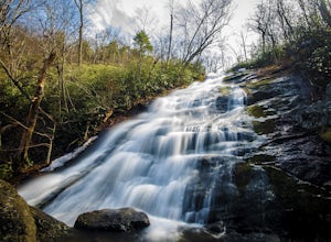
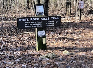
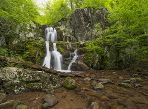
White Rock Falls Trail is an out-and-back trail that takes you by a waterfall located near Montebello, Virginia.
Backpack Reeds Gap to Rockfish Gap
Roseland, Virginia
5.0
20 mi
Note: We usually get a chance to take this trip in the summer, so please pay attention to the weather and pack accordingly. This description is for a July/August hike and the temperatures were in the 80s during the day and 60s at night. During this time of year rain showers are always a possibility and during our most recent trip it rained off and on every day, so this will also affect your pac...
Backpack Three Ridges Loop
Lyndhurst, Virginia
4.6
14.2 mi
/ 3960 ft gain
From the parking area at Reids Gap, start off on the white-blazed A.T heading south as the trail begins on the left side of a clearing. You will begin climbing Meadow Mountain shortly and in .8 miles arrive at the top of the ridge, where you will continue on downhill for another .8 miles until you reach the first intersection with the Mau-Har Trail. The Maupin Field Shelter is just down to yo...
Places to stay
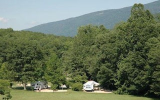
Lyndhurst, Virginia
Sherando Lake Recreation Area Family Camping
Overview
Sherando Lake Recreation Area's Family Campground provides an ideal camping destination. It is situated in the Blue Ridge Mounta...
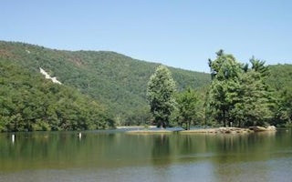
Lyndhurst, Virginia
Sherando Lake Group Picnic Shelter
Overview
Sherando Lake Group Picnic Shelter, also known as the Williams Branch Group Picnic Shelter is a part of the Sherando Lake Recrea...
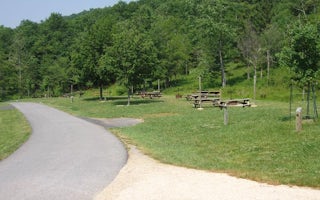
Lyndhurst, Virginia
Sherando Lake Group Camp
Overview
Sherando Lake Group Camp is a part of the Sherando Lake Recreation Area and is popular with family groups, Boy and Girl Scouts, ...
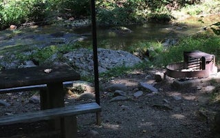
Monroe, Virginia
Otter Creek Campground
Overview
As Otter Creek descends to the James River, the Blue Ridge Parkway dips to its lowest elevation, only 649 feet above sea level. ...
Guides and stories
Quick links
- The best hiking trails in Tyro
- The best backpacking in Tyro
- The best camping in Tyro
- Top adventures in Tyro
Community
© 2023 The Outbound Collective - Terms of Use - Privacy Policy


