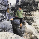
Scramble Bonticou Crag and Table Rocks
High Falls, New York
Description
Added by Michael Martineau
Distance: 5.5 miles. Rock scrambling. Catskill Mountain views. Crevasses. Elevation: 315ft scramble.
This is not a hike for the inexperienced. There is a very steep rock scramble that has some dangerous section if you are not aware of your footing and positioning. For those up to the challenge, it is extremely rewarding at the top.
To start, each person has to pay $12 to access the Monhonk Preserve. If you make a day out of this hike it is worth it (also always nice to donate to the conservation of good hiking land). From the parking lot you will want to head the way you came in and cross the road to pick up the Crag Trail (red). Follow this through some small meadows and look out for the red markers along the way. You’ll come to an intersection and you want to stay straight to continue on the Crag trail (red). Around .7 or .8 miles in, you will come to a section where three trails meet. The trail you want to go on is to your left (not sharp left like a u turn, just to the left). This trail is called Bonticou Road, follow it until you get to the marker for Bonticou Ascent Path (yellow).
When you reach Bonticou Ascent Path (yellow), the fun begins. You will walk down a little hill until you are at the base of the cliff. The yellow paint on the rocks is faded so keep a look out for them. Scramble on your hands and knees up rocks, duck through rock tunnels, and venture through crevasses till you reach the top. At the top, note the yellow arrow that points into the forest before you explore out on the rocks more. Take your time up here and for those daring enough, sit on the ledge to take in the views.
Once finished on top, go back to the yellow arrow and follow the trail into the forest and descending down the backside of the mountain. Be on the lookout for the Northeast Trail (light blue) that you will turn right on. In another couple of minutes there will be an opening on your left with fantastic views. Follow the Northeast Trail (light blue) till the end and then pick up the Clearwater Road trial (red). Following the relatively flat Clearwater Road trail until it joins up with Farm Road. To get to Table Rocks you pass farm road on your left and head downhill until you reach the Table Rocks Trail (about 1 mile). Once you get to the Table Rocks this is a great place to stop and have some lunch or a snack with more views. *Note, the crevasses here are very deep so be careful where you are stepping.
After taking in the views and enjoying the Table Rocks, retrace your steps back till you get to Farm Road. Turn right and follow Farm Road through some meadows and look out for snakes in the grass, especially if it is a nice sunny day out. *Be aware of new trails splitting off to the left and make sure you stay on Farm Road, which is marked with signs. When you come up to the gazebo on your left continue following the path past some outhouses. You will now start to see signs that say "Exit", follow those back to the parking lot with one more surprise view when you get to the top of a small hill.
Download the Outbound mobile app
Find adventures and camping on the go, share photos, use GPX tracks, and download maps for offline use.
Get the appFeatures
Reviews
Very fun hike! Absolutely beautiful during the fall!
4.0
There’s a hidden cave at the base of the rocks that is difficult to find unless you already know where it is. If you’re willing to spend time searching the base of the cliffs for openings in the rocks below you’ll enter a guided cave that you climb at times on your hands and knees through the entire rock base. You definitely need a headlamp for this endeavor but there are arrows spray painted around each turn pointing you in the correct direction through the cave system.
5.0
Leave No Trace
Always practice Leave No Trace ethics on your adventures and follow local regulations. Please explore responsibly!
Nearby
Mohonk Mountain House Labyrinth and Lemon Squeeze Hike
Hike Mohonk Preserve's Gatehouse to Skytop Tower
Hike to Sky Top via the Undercliff Road
Hike the Dickie Barre, Peters Kill and Awosting Falls Loop
Hike The Millbrook Mountain Ridge Trail
Hike the Overcliff - Undercliff Road Loop
Community
© 2023 The Outbound Collective - Terms of Use - Privacy Policy


