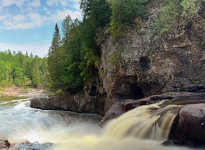
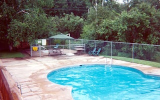
Two Harbors
Top Spots
Random Lighthouse
Two Harbors, Minnesota
0.85 mi
/ 33 ft gain
Random Lighthouse is an out-and-back trail that takes you by a lake located near Two Harbors, Minnesota.
Superior Hiking Trail: Crow Creek
Two Harbors, Minnesota
11.47 mi
/ 1453 ft gain
Superior Hiking Trail: Crow Creek is a point-to-point trail that provides a good opportunity to view wildlife located near Two Harbors, Minnesota.
Superior Hiking Trail: Gooseberry River, The Nestor Grade, and Wolf Rock
Two Harbors, Minnesota
14.99 mi
/ 1401 ft gain
Superior Hiking Trail: Gooseberry River, The Nestor Grade, and Wolf Rock is an out-and-back trail that takes you by a river located near Two Harbors, Minnesota.
Photograph Stoney Point Beach on Lake Superior
Duluth, Minnesota
The AdventureThe work is done. According to The Photographer’s Ephemeris (app.photoephemeris.com) the sun will rise at 7:11 AM. You grab your gear, a hot beverage, and set out for the open road. Scenic 61 follows the shore of Lake Superior all the way from Duluth to Two Harbors, MN. The drive up offers multiple stunning views of the world’s largest freshwater lake. As you drive you notice that ...
Gitchi-Gami from Gooseberry to Split Rock
Two Harbors, Minnesota
15.28 mi
/ 1440 ft gain
The Gitchi-Gami is a paved bike path that will eventually extend from Two Harbors to Grand Marais. As it currently stands (2015), there's a really great segment that starts in Gooseberry Falls State Park and runs all the way to the town of Beaver Bay (total of 16 miles one way).
I chose to do a shorter section and bike the 8 miles (one way) from Gooseberry Falls State Park to Split Rock State ...
Gitchi Gummi Trail
Two Harbors, Minnesota
2.29 mi
/ 322 ft gain
Gitchi Gummi Trail is a point-to-point trail that takes you by a lake located near Beaver Bay, Minnesota.
Explore Gooseberry Falls
Two Harbors, Minnesota
4.6
Gooseberry Falls State Park is the first State Park you hit traveling up the North Shore after leaving Duluth. Located 13 miles north of Two Harbors on Highway 61, Gooseberry Falls State Park a quick turn off of the highway which is very well marked with signs. Follow signs for Falls parking.You can stop by the Visitor’s Center to pick up a map of the park, visit some of the exhibits they have,...
Snowshoe to Corundum Point at Split Rock Lighthouse State Park
Two Harbors, Minnesota
5.8 mi
/ 240 ft gain
Although there are dozens of ways to do this trip and I encourage you to explore, I suggest one hike that I think does a good job of introducing this areas to new visitors. If you are planning on snowshoeing like I suggest, try to get a day with a good amount of fresh snow (6+ inches). Packed snow works fine and is easier to handle, but it's just not as fun.Almost all of the Minnesota State Par...
Hike to the Fifth Falls of the Gooseberry River
Two Harbors, Minnesota
3.8
2 mi
/ 100 ft gain
Gooseberry Falls State Park is the first State Park you hit traveling up the North Shore after leaving Duluth. Located 13 miles north of Two Harbors on Highway 61, Gooseberry Falls State Park a quick turn off of the highway which is very well marked with signs. Follow signs for Falls parking.
Begin your hike from the Visitor Center and follow signs for the Upper Falls. The trail starts out pave...
Places to stay
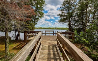
Brimson, Minnesota
Cadotte Lake
Overview
Cadotte Lake Campground lines the western shore of Cadotte Lake in Superior National Forest. A boat ramp and fishing dock make t...
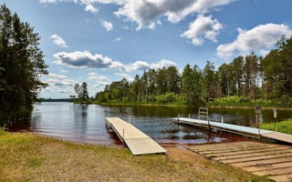
Makinen, Minnesota
Whiteface Reservoir
Overview
Whiteface Reservoir Campground offers an ideal getaway for anglers, boaters and families. The provided swim beach, accessible fi...
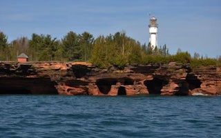
Bayfield, Wisconsin
Apostle Islands National Lakeshore Camping Permits
Overview
The Apostle Islands are Wisconsin's northernmost landscape. Apostle Islands National Lakeshore includes 21 islands and 12 miles ...
Quick links
- The best hiking trails in Two Harbors
- The best backpacking in Two Harbors
- The best camping in Two Harbors
- Top adventures in Two Harbors
Community
© 2023 The Outbound Collective - Terms of Use - Privacy Policy


