Clayton
Top Spots
Donner Canyon Road to Mitchell Canyon Road Loop
Clayton, California
10.09 mi
/ 1322 ft gain
Donner Canyon Road to Mitchell Canyon Road Loop is a loop trail that takes you by a waterfall located near Clayton, California.
Black Diamonds to Mount Diablo Regional Trail and Nortonville Trail Loop
Clayton, California
10.49 mi
/ 2021 ft gain
Black Diamonds to Mount Diablo Regional Trail and Nortonville Trail Loop is a loop trail where you may see wildflowers located near Clayton, California.
Mount Diablo Summit via Mitchell Canyon Loop
Clayton, California
12.57 mi
/ 3402 ft gain
Mount Diablo Summit via Mitchell Canyon Loop is a loop trail where you may see beautiful wildflowers located near Clayton, California.
Back Creek Trail and Bald Ridge Trail to Mount Diablo Summit
Clayton, California
10.69 mi
/ 3376 ft gain
Back Creek Trail and Bald Ridge Trail to Mount Diablo Summit is an out-and-back trail where you may see wildflowers located near Clayton, California.
Mitchell Canyon, Juniper Trail, Summit, Prospector's Gap, Falls Trail, Donner Canyon
Clayton, California
14.6 mi
/ 4003 ft gain
Mitchell Canyon, Juniper Trail, Summit, Prospector's Gap, Falls Trail, Donner Canyon is a loop trail that takes you by a waterfall located near Clayton, California.
Hike the Waterfalls of Mount Diablo Loop Trail
Clayton, California
5.0
6 mi
/ 1627 ft gain
Winter and spring rains create scenic waterfalls in this hike at Mount Diablo, the East Bay's signature peak. Be careful hiking immediately post-rain, watch for slippery sections of mud. The trail is moderately difficult and is used by hikers, walking groups, trail runners, and for nature trips.
This hike starts out from the Regency Gate in the East Bay town of Clayton. Park on the street and ...
Eagle Peak Meridian Ridge Loop
Clayton, California
7.64 mi
/ 2451 ft gain
Eagle Peak Meridian Ridge Loop is a loop trail where you may see beautiful wildflowers located near Clayton, California.
North Peak via Donner Canyon Road and Meridian Ridge Road
Clayton, California
10.04 mi
/ 3248 ft gain
North Peak via Donner Canyon Road and Meridian Ridge Road is an out-and-back trail where you may see beautiful wildflowers located near Clayton, California.
Eagle Peak Trail to Back Creek Trail
Clayton, California
6.04 mi
/ 2149 ft gain
Eagle Peak Trail to Back Creek Trail is a loop trail where you may see beautiful wildflowers located near Clayton, California.
Places to stay

San Francisco, California
Aquatic Park Cove San Francisco Maritime Nhp
Overview
Aquatic Park Cove is a vibrantly urban harbor that mimics a natural anchorage and is located on the Pacific shores of one of Ame...
From $10 / night

Sausalito, California
Bicentennial Campground
Overview
Bicentennial Campground is in an ideal location in the Marin Headlands surrounded by a grove of cypress trees. The campground is...
From $20 / night
Napa, California
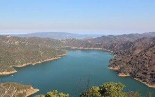
Oak Shores Day Use Area (Ca)
Overview
Nestled between Blue Ridge and Cedar Roughs east of Napa Valley, Lake Berryessa provides ample public recreation opportunities. ...
Guides and stories
Quick links
- The best hiking trails in Clayton
- The best backpacking in Clayton
- The best camping in Clayton
- Top adventures in Clayton
Community
© 2023 The Outbound Collective - Terms of Use - Privacy Policy


