Burnsville
Top Spots
Camp at Snaggy Mountain
Burnsville, North Carolina
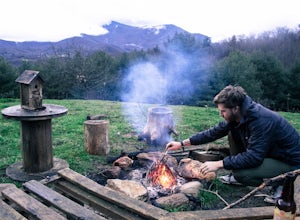
Snaggy Mountain is privately owned land that offers a beautiful camping spot located just outside of the Pigsah National Forest. It's completely secluded by an Apple Orchard and is a great home base for several hiking adventures in the area. The location on the map will get you to the parking spot and from there it is a short 10 minute hike to the spot marked by a fire ring. If you're in the ar...
Backpack the Black Mountain Crest Trail
Burnsville, North Carolina
12 mi
/ 5390 ft gain
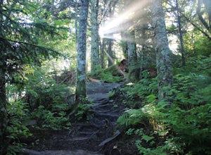
The Black Mountain Crest Trail is legendary among hikers in the southeast. It is the highest trail east of the Mississippi, as it traverses the summit of several peaks over 6,000 feet. It is also widely acknowledged as one of the premier hikes on the east coast. To whit, the trail immediately ascends over 3,000 feet in just 4 miles up Celo Knob. After a short respite at Horse Rock Meadows, the ...
Black Crest Trail and Mount Mitchell
Burnsville, North Carolina
16.15 mi
/ 4987 ft gain
Black Crest Trail and Mount Mitchell is a point-to-point trail where you may see local wildlife located near Burnsville, North Carolina.
Woody Ridge Trail
Burnsville, North Carolina
4.51 mi
/ 2867 ft gain
Woody Ridge Trail is an out-and-back trail that takes you past scenic surroundings located near Burnsville, North Carolina.
Big Butt Peak, Cattail Peak, Mount Mitchell and Gibbs Mountain
Burnsville, North Carolina
24.38 mi
/ 5919 ft gain
Big Butt Peak, Cattail Peak, Mount Mitchell and Gibbs Mountain is a point-to-point trail where you may see beautiful wildflowers located near Burnsville, North Carolina.
Straight Creek via Waterslide Trail
Barnardsville, North Carolina
1.39 mi
/ 400 ft gain
Straight Creek via Waterslide Trail is an out-and-back trail that takes you through a nice forest located near Barnardsville, North Carolina.
Celo Knob Via Black Mountain Crest and Colbert Ridge Trails
Burnsville, North Carolina
13.97 mi
/ 4446 ft gain
Celo Knob Via Black Mountain Crest and Colbert Ridge Trails is an out-and-back trail that takes you past scenic surroundings located near Burnsville, North Carolina.
Colbert Ridge to Mount Mitchell to Maple Camp Ridge Loop
Burnsville, North Carolina
18.22 mi
/ 5066 ft gain
Colbert Ridge to Mount Mitchell to Maple Camp Ridge Loop is a loop trail that takes you through a nice forest located near Burnsville, North Carolina.
Big Bald
Burnsville, North Carolina
14.13 mi
/ 3448 ft gain
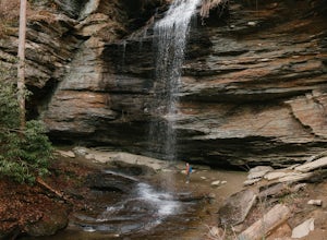
Big Bald is an out-and-back trail that takes you by a waterfall located near Burnsville, North Carolina.
Places to stay
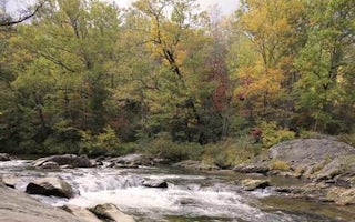
Burnsville, North Carolina
Carolina Hemlocks Rec Area
Overview
Carolina Hemlocks Recreation Area sits in the scenic mountains of Pisgah National Forest. This is a great place for small to med...
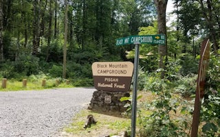
Burnsville, North Carolina
Black Mountain Campground
Overview
Black Mountain Campground sits in the shadow of Mt. Mitchell, the highest peak in the eastern U.S. and borders the South Toe Riv...
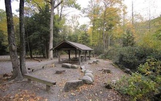
Burnsville, North Carolina
Briar Bottom Group Campground
Overview
Briar Bottom Group Campground is the perfect getaway for visitors to enjoy mountain scenery and easy access to hiking trails. Th...
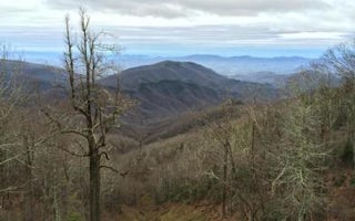
Old Fort, North Carolina
Curtis Creek Campground (Nc)
Overview
Curtis Creek Campground is nestled in the mountains at the base of the Blue Ridge just minutes from the quaint town of Old Fort ...
37692
Rock Creek Recreation Area
Overview
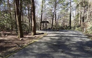
Rock Creek Recreation Area is named for the small creek that runs alongside this recreation site. The facilities, creek-fed co...
Guides and stories
Quick links
- The best hiking trails in Burnsville
- The best backpacking in Burnsville
- The best camping in Burnsville
- Top adventures in Burnsville
Community
© 2023 The Outbound Collective - Terms of Use - Privacy Policy
