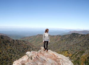
The Best Hiking in Great Smoky Mountains National Park
Looking for the best hiking in Great Smoky Mountains National Park? We've got you covered with the top trails, trips, hiking, backpacking, camping and more around Great Smoky Mountains National Park. The detailed guides, photos, and reviews are all submitted by the Outbound community.
Top hiking spots in and near Great Smoky Mountains National Park
-
Gatlinburg, Tennessee
Cove Hardwoods Nature Trail
0.86 mi / 197 ft gainCove Hardwoods Nature Trail is a loop trail where you may see beautiful wildflowers located near Gatlinburg, Tennessee.Read more -
Gatlinburg, Tennessee
Hike the Chimney Tops
4.94.03 mi / 1487 ft gainThe Chimney Tops Trail is one of the most visited trails in the Smokies, which is why I recommend going up just before sunset to beat the crowd! During the summer and fall months, it's common to see a hundred people taking in the views on the same trail, but if you scramble on out after hours, y...Read more -
Bryson City, North Carolina
Spruce Fir Self-Guiding Nature Trail
0.61 mi / 20 ft gainSpruce Fir Self-Guiding Nature Trail is a loop trail where you may see beautiful wildflowers located near Cherokee, North Carolina.Read more -
Gatlinburg, Tennessee
Appalachian Trail: Charlie's Bunion and Kephart Loop
5.016.84 mi / 4429 ft gainAppalachian Trail: Charlie's Bunion and Kephart Loop is a loop trail that takes you by a waterfall located near Cherokee, North Carolina.Read more -
Gatlinburg, Tennessee
Peregrine Peak via Alum Cave Bluffs Trail
4.54 mi / 1325 ft gainPeregrine Peak via Alum Cave Bluffs Trail is an out-and-back trail where you may see beautiful wildflowers located near Gatlinburg, Tennessee.Read more -
Gatlinburg, Tennessee
Hike to Mt. LeConte via Alum Cave Bluff
5.010.68 mi / 3982 ft gainThe Alum Cave trailhead is on Newfound Gap Road, 8 miles from the Sugarlands Visitor Center. Mt. LeConte is the third highest peak in the Smokies, and this is an extremely popular hike, so arrive early to get a parking spot and beat the crowds. Starting from the parking lot the trail gently wind...Read more -
35.629385,-83.450994
Camp out at Mt. LeConte Lodge via Alum Cave
5.09.96 miAt the summit of Mt. LeConte in the Great Smoky Mountains National Park, the lodge sits at a elevation of 6400 feet. It is the only "accommodations" inside the park boundaries. It is the highest lodge in the eastern United States. Accessible only by hiking one of the five trails to the summit,...Read more -
Gatlinburg, Tennessee
Courthouse Rock Trail
2.53 mi / 804 ft gainCourthouse Rock Trail is an out-and-back trail that takes you by a waterfall located near Gatlinburg, Tennessee.Read more -
Gatlinburg, Tennessee
Quilliam Cave via Courthouse Rock Trail
2.85 mi / 1404 ft gainQuilliam Cave via Courthouse Rock Trail is an out-and-back trail that takes you by a river located near Gatlinburg, Tennessee.Read more -
Bryson City, Tennessee
Appalachian Trail: Clingman Dome to Cades Cove
24.46 mi / 2818 ft gainAppalachian Trail: Clingman Dome to Cades Cove is a point-to-point trail where you may see beautiful wildflowers located near Gatlinburg, Tennessee.Read more -
35.610235,-83.426410
Myrtle Point via Alum Cave
5.015.43 mi / 3100 ft gainThis hike can be started at the Alum Cave trailhead or the Boulevard Trailhead. For this particular adventure, the starting point is Alum Cave. If you're lucky enough to stay the night at the backcountry shelter on top of Mt. LeConte, (add 0.2 miles if coming from the Lodge), head east on the Bou...Read more -
Gatlinburg, Tennessee
Newfound Gap to Indian Gap
3.41 mi / 823 ft gainNewfound Gap to Indian Gap is an out-and-back trail that takes you through a nice forest located near Gatlinburg, Tennessee.Read more -
Gatlinburg, Tennessee
Charlies Bunion via Appalachian Trail
5.04.32 mi / 1640 ft gainFrom the Sugarlands Visitor Center near Gatlinburg, drive approximately 13 miles south on Newfound Gap Road to reach the Newfound Gap Parking Area (it'll be on your left). The parking area is free and there are bathrooms. Follow the Appalachian Trail towards Katahdin, Maine (1972 miles away, woah...Read more -
Bryson City, Tennessee
Appalachian Trail: Newfound Gap to Davenport Gap
30.85 mi / 5830 ft gainAppalachian Trail: Newfound Gap to Davenport Gap is a point-to-point trail where you may see beautiful wildflowers located near Gatlinburg, Tennessee.Read more -
Bryson City, Tennessee
Appalachian Trail: Newfound Gap to Fontana Lake
38.92 mi / 6703 ft gainAppalachian Trail: Newfound Gap to Fontana Lake is a point-to-point trail where you may see beautiful wildflowers located near Gatlinburg, Tennessee.Read more -
Gatlinburg, Tennessee
Newfound Gap Loop via Goshen Prong to Sugarland Mountain
29.34 mi / 6345 ft gainNewfound Gap Loop via Goshen Prong to Sugarland Mountain is a loop trail where you may see local wildlife located near Gatlinburg, Tennessee.Read more


