Poway
Top Spots
Rattlesnake Creek Trail
Poway, California
2.2 mi
/ 232 ft gain
Rattlesnake Creek Trail is an out and back trail where you may see wildflowers located near Poway, California
Catch a Sunset at Twin Peaks Mountain
Poway, California
2 mi
Start by parking at Silverset Park. You will see the trail head for Twin Peaks just behind the park. Park outside of the park if you think you'll be staying past sunset, as the park gates close at dark! Once you spot the trail head, veer left to the path heading up towards the peaks. You will eventually get to a fork in the trail. Heading left takes you on a more moderate ascent to one of the p...
Lower Twin Peak Trail Loop
Poway, California
2.65 mi
/ 554 ft gain
Lower Twin Peak Trail Loop is a loop trail that provides a good opportunity to see wildlife located near Poway, California.
Twin Peaks Trail
Poway, California
1.94 mi
/ 755 ft gain
Twin Peaks Trail is a loop trail that takes you past scenic surroundings located near Poway, California.
Mount Woodson and Potato Chip Rock
Poway, California
4.6
6.45 mi
/ 900 ft gain
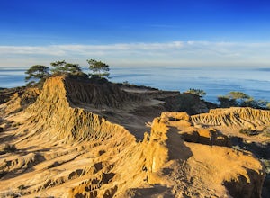
Mt. Woodson is located in Poway's most eastern region and is one of San Diego's most popular and most iconic hiking trails. Known for its grand photo opportunistic "Potato Chip Rock", Mt. Woodson is a 7.5mi out-and-back trail with amazing vistas, convenient rest stops and breathtaking views.
The trailhead begins at Poway Lake & Park (open 6:00am-5:00pm) and the parking fee is $5.00 to ente...
Relax at Lake Poway
Poway, California
4.0
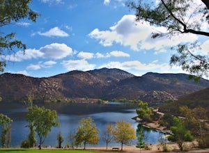
It costs $5 to enter the park and they are open 6am to sunset everyday. There is plenty of parking and this park is huge! This place has so many outdoor recreational activities such as fishing, hiking, running, archery, feeding ducks, or just having a picnic.
With so many possibilities in this one area, why not do them all in one day? My typical day here involves a picnic overlooking the lake, ...
Lake Poway Loop Trail
Poway, California
5.0
2.79 mi
/ 512 ft gain
Lake Poway Loop Trail is a loop trail that takes you by a waterfall located near Poway, California.
Hike around Goodan Ranch
Poway, California
5.0
3 mi
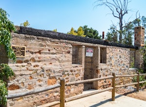
Starting at the Sycamore Canyon Trail head, you will see the sign and gate that leads to Goodan Ranch. Head down the gravel road for 1.1 miles, until you reach a 3-way directional split. Heading straight for another .5 miles will take you directly to the ruins of the old Goodan house. Here you will find bathrooms, shaded resting areas, and water fountains. The visitor center, when open, has som...
Sycamore Canyon Preserve
Poway, California
6.7 mi
/ 843 ft gain
Sycamore Canyon Preserve is a loop trail where you may see wildflowers located near Poway, California.
Places to stay
Palomar Mountain, California
Observatory Campground
Overview
Science buffs and families are drawn to Observatory Campground for its proximity to the Palomar Observatory, a world-class cente...
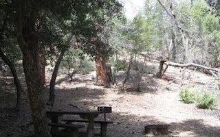
Palomar Mountain, California
Fry Creek Campground
Overview
Fry Creek Campground is situated in the heart of Cleveland National Forest, uniquely located down the road from the world-famous...
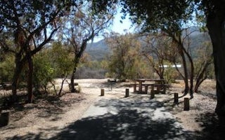
Warner Springs, California
Oak Grove Campground
Overview
Located on the Cleveland National Forest, Oak Grove Campground is nestled in a valley of large oak groves and manzanita.Recreati...
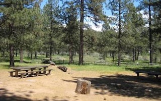
Laguna Meadow Road
El Prado Group
Overview
El Prado Group Campground is a great mountain getaway just one hour east of San Diego, California in the Laguna Mountain Recreat...
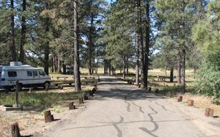
Mount Laguna, California
Laguna
Overview
Laguna Campground is a great mountain getaway just one hour east of San Diego, California in the Laguna Mountain Recreation Area...
Guides and stories
Quick links
- The best hiking trails in Poway
- The best backpacking in Poway
- The best camping in Poway
- Top adventures in Poway
Community
© 2023 The Outbound Collective - Terms of Use - Privacy Policy


