Death Valley
Top Spots
Explore Skidoo Road
Inyo County, California
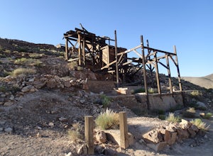
Skidoo Road is the first dirt road on the left you encounter when driving Emigrant Canyon Road. The road is suitable for any car until you reach an old mine on the right atop a hill. Directly to the left is a prospector's wood cabin. Both are in very good condition and worthy of a stop to check out.
Beyond this point the road makes a sharp left. After this point, a high clearance vehicle is...
Mosaic Canyon Trail
Stovepipe Wells, California
3.53 mi
/ 1224 ft gain
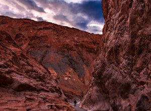
Mosaic Canyon Trail is an out-and-back trail that provides a good opportunity to view wildlife located near Death Valley, California.
Hike Mosaic Canyon, Death Valley
DEATH VALLEY, California
4.0
2 mi
/ 814 ft gain
Mosaic Canyon is located a quarter mile west of Stovepipe Wells Village. From the 190 Highway, take the 2 mile gravel road to the canyon parking lot. The road is very rough and bumpy, but a regular passenger car will be able to make the drive. A high clearance 4x4 vehicle will not have any problems.From the parking lot, it's a 1/4 mile walk to the beginning of the canyon narrows. Some sections ...
Grotto Canyon
Death Valley, California
2.09 mi
/ 702 ft gain
Grotto Canyon is an out-and-back trail where you may see local wildlife located near Death Valley, California.
Explore Grotto Canyon
Death Valley, California
2.1 mi
/ 649 ft gain
This is a rewarding hike with immediate payoff. After less than half a mile, you'll come across dry falls. Dogs are allowed on this trail but must be kept on leash. Make sure your vehicle has 4WD to avoid getting stuck in the deep sand in the parking area and on the drive.
Explore the Eureka Mine and the Cashier Mill
Inyo County, California
The Eureka Mine was a gold mine founded by Shorty Harris and Pete Aguereberry. Pete won a legal battle and took control of the mine in 1909. It is said that the mine kept Pete making money for 40 years and earned $175,000 from the mine. That was at $20 per ounce. At current gold prices, the amount of gold pulled from Eureka would be $11,550,000! Makes you think of becoming a gold miner. But it ...
Explore Aguereberry Camp
Inyo County, California
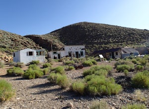
Pete Agueberry came Death Valley in 1905. After a legal battle, Pete gained control of the Eureka Mine in 1909. He worked the mine alone for nearly 40 years before his death. The original cabin that Pete lived in is still on the site. The buildings in the front were built in the 1940's as guest houses. These buildings seem to have more items intact. One building still has a water heater and old...
Little Bridge Canyon Trail
Stovepipe Wells, California
5.75 mi
/ 1867 ft gain
Little Bridge Canyon Trail is an out-and-back trail where you may see wildflowers located near Death Valley, California.
Drive Aguereberry Point Road
Harrisburg, California
This was one of the more enjoyable drives I did in the park. I explored the area late one afternoon, checking out Aguereberry Camp and the Eureka Mine when I decided to explore further up to the end of Aguereberry Road.
The drive is awesome, especially late in the day. The road is accessible by two wheel car but the last few hundred yards are steep but easy enough. At the end is a wide are ...
Places to stay
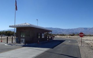
Furnace Creek, California
Furnace Creek
Overview
Furnace Creek Campground is in a central location in Death Valley National Park. It is popular for RV and group camping; tent si...
Guides and stories
Quick links
- The best hiking trails in Death Valley
- The best backpacking in Death Valley
- The best camping in Death Valley
- Top adventures in Death Valley
Community
© 2023 The Outbound Collective - Terms of Use - Privacy Policy
