California
About
California truly has it all. Where else can you find so much pristine coastline, otherworldly desert, epic granite mountains, and giant redwood forests? Take an extended road trip on Highway 1 or 395 and you'll see what we mean.
Top Spots
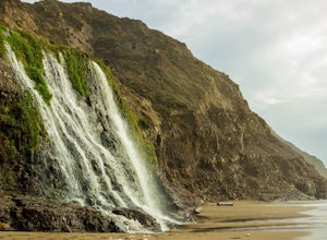
Alamere Falls via Palomarin Trailhead
Bolinas, California
4.5
13.54 mi
/ 1614 ft gain
Alamere Falls is the tallest waterfall in the bay area. It is known as a tide fall because it empties directly into the Pacific Ocean. This is extremely unique because there are only 34 tide falls in the world and two in California, the other being McWay Falls in Big Sur. Enjoy stunning views of the pacific combined with varying terrain through forests, tall brush, and exposed dirt trails. If ...
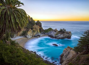
McWay Falls
Big Sur, California
4.6
McWay Falls is one of the most iconic waterfalls in BIg Sur and can be seen from Highway 1. The trail to the falls is located in Julia Pfeiffer. For all of you history buffs, Mcway Falls is named after Christopher McWay, an early settler and farmer from New York who ventured west in the late 1800s.
To get there, from the parking lot, walk back towards Highway 1 and look for the sign to the Wat...
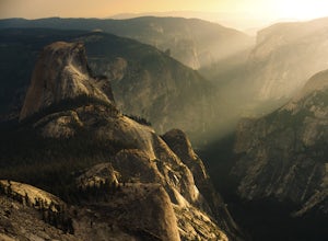
Sunrise Lakes to Clouds Rest
Mariposa County, California
4.7
18.93 mi
/ 1775 ft gain
Start out at the Tenaya Lake Trailhead, where you can head directly onto the trail for Clouds Rest or you can branch off after 2.7 miles to Sunrise Lakes. This allows you to break up the hike, spend a night relaxing and help you have an early start back on the trail.
Once re-connected to the Clouds Rest trail you begin a brief descent before you come across the only lake on the CR Trail. You d...
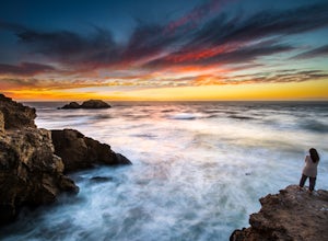
Lands End Trail
San Francisco, California
4.7
3.26 mi
/ 500 ft gain
Background
The Lands End Trail in the Golden Gate National Recreation Area is a fairly easy 3.26 mile out-and-back hike along the coastline of San Francisco. Entrances to the trail are at both the Visitor Center parking Lot just up from Cliff House or in the Sea Cliff neighborhood off of El Camino del Mar (near the Lincoln Golf Course and Legion of Honor).
When to Visit
Be sure to arrive at...
Sykes Hot Springs via Pine Ridge Trail
Big Sur, California
4.2
18.96 mi
/ 7339 ft gain
The trek to Sykes Hot Springs is about 10-miles one way along the Pine Ridge Trail. This is a great backpacking trip, but can be done as an out-and-back hike from the campgrounds at Pfeiffer Big Sur State Park if you're really moving.
The trail is moderately challenging, you'll cross the river twice - be careful in the winter and spring months, when the water runs fast. If it looks too fast, w...
Wisdom Tree
Los Angeles, California
4.8
0.95 mi
/ 528 ft gain
In Griffith Park, park along Lake Hollywood Drive and walk the paved quarter mile up Wonder View Drive to the start of Wonder View Trail. Here, walk through the yellow gate and make the first right after the road turns to dirt. Head up this unmarked single track path heading east up the mountain.
The steep, rocky trail ascends to Cahuenga Peak. A Half of a mile from the end of the road, it rea...
Cataract Falls
Stinson Beach, California
4.2
2.81 mi
/ 1184 ft gain
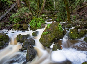
The Bay Area is home to many beautiful waterfalls, but Cataract Falls located about an hour north of San Francisco is one of the most stunning. Be sure to head out on this hike after a recent rain.
The Trail
Cataract Falls is a 3-mile total out-and-back hike that gains 750ft in the first mile. Unlike Alamere Falls, where you trek for 4 miles to get to the falls, you start to see cascading wa...
Canopy, Panoramic, Redwood Trail, Sun, Dipsea Trail Loop
Mill Valley, California
4.7
4.31 mi
/ 1145 ft gain
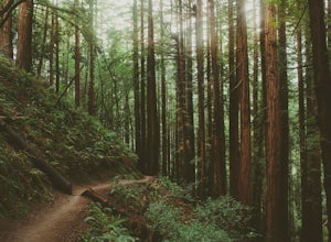
While there are other, less crowded redwood groves in the Bay Area, Muir Woods National Monument is easily one of the best. It is a beautifully maintained site, with wooden footpaths meandering between towering redwoods that are between 600 – 800 years old. It’s home to some true giants, with its tallest trees reaching over 250 ft in height.
Muir Woods contains 6 miles of trails (see trail map...
Tall Trees Grove, Redwood Creek, Emerald Ridge Loop
Orick, California
4.4
4.41 mi
/ 1043 ft gain
Day 1: Check with the Rangers station before heading up for best camping opportunities. Assuming you've checked with the rangers for approval...if there are openings, off of the main road, there are side streets with access to the beaches. Pull into one of these areas and drive down as far as you can – this may involve squeezing your car through spaces between boulders. If you find such a spot,...
Places to stay
Big Pine, California
Upper Sage Flat
Overview
Take the family to Upper Sage for a pleasant camping trip along the banks of Big Pine Creek. Here, visitors can experience the b...
Angelus Oaks, California
Heart Bar Equestrian
Overview
The Heart Bar Equestrian Campground is available by reservation and is for equestrian campers only. It provides access to some o...
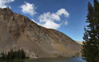
Bridgeport, California
Trumbull Lake
Overview
Trumbull Lake Campground is located next to its scenic namesake at an elevation of 9,980 feet. The lake is one of ten alpine lak...
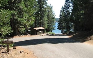
El Dorado County, California
Yellowjacket
Overview
Yellowjacket Campground provides plenty of opportunities for outdoor fun on Union Valley Reservoir. The water plays host to an a...
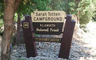
Siskiyou County, California
Sarah Totten Campground
Overview
Sarah Totten Campground is located next to the Klamath Wild and Scenic River, about 33 miles east of the town of Happy Camp. The...
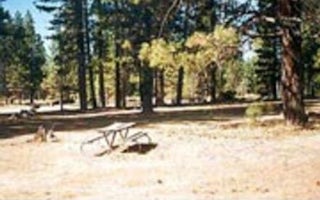
Canyondam, California
Almanor
Overview
Almanor Campground is a large family-friendly facility for individuals and large groups alike. It provides direct access to beau...
Guides and stories
Quick links
- The best hiking trails in California
- The best backpacking in California
- The best camping in California
- Top adventures in California
More California destinations
- San Diego
- Mariposa County
- Los Angeles
- South Lake Tahoe
- Inyo County
- South Lake
- San Francisco
- Yosemite
- Big Sur
- Bishop
- Malibu
- Laguna Beach
- Mammoth Lakes
- Ventura
- Sequoia National Park
- Mill Valley
- Twentynine Palms
- Wawona
- Mammoth
- Mammoth Lake
- San Jose
- Tuolumne County
- Riverside County
- Newport Beach
- Santa Cruz
- Lake
- Yosemite National Park
- Lee Vining
- Martinez
- Shasta County
- Point Reyes Station
- Yosemite Valley
- Truckee
- Oakland
- Borrego Springs
- Orick
- San Bernardino County
- Arnold
- Half Moon Bay
- San Diego County
- Stinson Beach
- Inverness
- Madera County
- Redwood City
- Sausalito
- Julian
- Lone Pine
- Pescadero
- Sequoia
- Shaver Lake
- Kyburz
- Lakeshore
- Nevada City
- Pacific
- Rancho Palos Verdes
- Thousand Oaks
- Three Rivers
- Bridgeport
- Groveland
- Hume
- Jenner
- Los Gatos
- Madera
- Mono County
- Palm Springs
- San Luis Obispo
- Trinity Center
- Auburn
- Big Bear
- Glendale
- Los Angeles County
- Poway
- Shasta
- Tulare County
- Azusa
- Bolinas
- Carmel-by-the-Sea
- Crescent City
- Fairfax
- Fremont
- Marin County
- Mount Baldy
- Pacific Grove
- Pinecrest
- Ramona
- Santa Barbara County
- Soda Springs
- Topanga
- Trabuco Canyon
- Woodside
- Altadena
- Berkeley
- Calistoga
- Echo Lake
- Furnace Creek
- Livermore
- Mendocino
- Morgan Hill
- Napa
- Newport
- Oceanside
- Palo Alto
- Richmond
- Santa Barbara
- Tahoma
- Walnut Creek
- Avalon
- Boulder Creek
- Lake Elsinore
- Ojai
- Old Station
- Olympic Valley
- Pacifica
- Palmdale
- Tahoe City
- Tulelake
- Whitethorn
- Calabasas
- Castro Valley
- Clayton
- Dana Point
- Escondido
- Grove
- Independence
- Junction City
- Laguna Niguel
- La Honda
- Markleeville
- McCloud
- Mount Laguna
- Orinda
- Paicines
- Pearblossom
- San Rafael
- Santa Rosa
- Tulare
- Twin Bridges
- Yucca Valley
- Agoura Hills
- Aliso Viejo
- Antioch
- Bakersfield
- Chester
- Cool
- Death Valley
- Felton
- Fresno County
- Gilroy
- Junction
- Kern County
- Lafayette
- Lake Forest
- Los Altos
- Maricopa
- Montecito
- Orange
- Palomar Mountain
- Pleasanton
- Point Reyes
- Santee
- Silverado
Community
© 2023 The Outbound Collective - Terms of Use - Privacy Policy
